

31 Aug 2026 26 min to read
Manaslu Circuit Trek weather is more complicated than simply checking the forecast before leaving Kathmandu. The route travels through several elevation zones, deep valleys, forests, open mountain terrain and a high Himalayan pass above 5,000 meters. As a result, weather can change considerably from one part of the trail to another.
A warm afternoon near Machha Khola does not tell you what conditions will be like around Samdo. Likewise, clear skies at Samagaun do not guarantee calm weather at Larkya La several hours later.
For trekkers, understanding these differences is more useful than memorizing a single temperature chart. You need to know how altitude affects temperature, why wind matters, when clouds normally build, how snow changes the trail, and which weather conditions deserve extra caution.
This practical guide explains the less obvious side of Manaslu Circuit weather and temperature, helping you understand what you may actually experience on the trail.
One of the most remarkable features of the Manaslu Circuit is its enormous elevation range.
The trek starts in the relatively warm lower Budhi Gandaki Valley and gradually climbs toward the colder alpine environment around Samagaun, Samdo, Dharamsala and Larkya La.
This means that “Manaslu weather” is not one type of weather.
You can broadly think of the route as four different weather environments:
| Trekking Zone | Approx. Elevation | Typical Weather Character |
|---|---|---|
| Lower Budhi Gandaki | ~700–2,000 m | Warm, humid and greener |
| Middle Manaslu | ~2,000–3,500 m | Cooler with strong day/night variation |
| Upper Nubri Valley | ~3,500–4,000 m | Cold, dry and increasingly exposed |
| Larkya La Zone | ~4,000–5,160 m | Freezing, windy and highly changeable |
These are broad climatic zones rather than strict boundaries. Local geography, season, cloud cover and recent weather can produce significant variations.
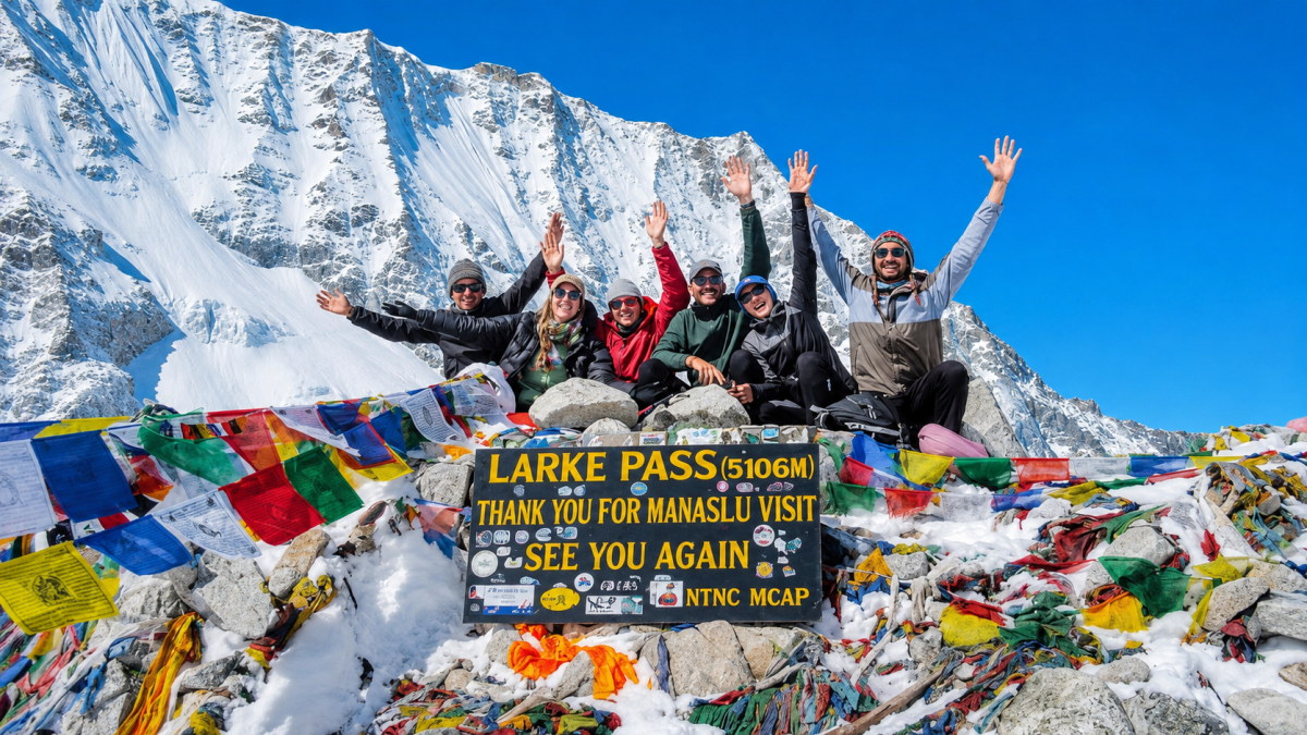
Altitude is the main reason temperatures change so dramatically during the trek.
As you gain elevation, the air generally becomes colder. But trekkers often notice something else: the difference between sunshine and shade becomes much greater.
At high altitude, strong sunlight can make a calm afternoon feel surprisingly pleasant. Step into shade, encounter cloud cover, or walk into a strong wind, and the same environment can suddenly feel much colder.
This is why a weather forecast showing one temperature does not tell the whole story.
Your actual experience depends on:
A good Manaslu clothing system therefore needs to be flexible rather than based on one expected temperature.
Temperature changes throughout the day are particularly noticeable in the mountains.
During sunny periods, the ground and surrounding slopes warm during the day. Once the sun becomes weaker or disappears behind the mountains, temperatures can fall rapidly.
This is particularly noticeable in higher settlements such as Samagaun and Samdo.
A trekker may start walking wearing several layers, remove one during the climb, and then need the jacket again when the trail becomes shaded or the wind increases.
This is completely normal.
Do not pack according to the warmest temperature you expect. Pack according to the coldest conditions you may encounter.
That is especially important for the night at Dharamsala and the early-morning journey toward Larkya La.
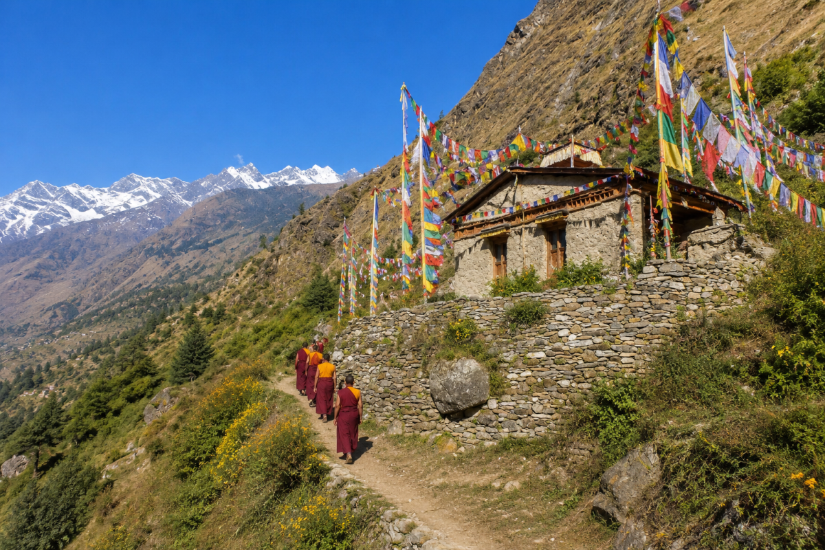
Weather on the Manaslu Circuit can change throughout the day, especially as the trail gains altitude. Understanding this daily pattern helps trekkers choose better walking times, prepare suitable clothing, and avoid spending unnecessary time in exposed areas when conditions become less favorable.
Early mornings are usually the coldest part of the day, particularly above 3,000 meters. Around Samagaun, Samdo and Dharamsala, temperatures can be below freezing during the colder trekking months.
However, cold mornings often come with good visibility. After a clear night, mountain peaks may appear sharp and unobstructed, making early morning a particularly good time for Himalayan views and photography.
Wind can also be relatively manageable during the early hours, although this varies with location and weather conditions.
For trekkers, the main challenge is the cold. Warm layers, gloves, a hat and a good insulated jacket are especially useful when leaving early.
As the sun rises, temperatures gradually become more comfortable. This is often an enjoyable period for trekking because the combination of daylight and physical activity helps reduce the feeling of cold.
On sunny days, trekkers may remove an outer layer while walking uphill. However, conditions can still vary considerably between sunny and shaded sections.At higher elevations, do not assume that warmer sunshine means the weather will remain stable throughout the day.
By afternoon, mountain conditions can become more variable.
As the slopes warm, clouds may begin forming around ridges and peaks. Wind can also increase in exposed areas, particularly on open sections of the upper Manaslu trail.This does not mean that bad weather arrives every afternoon. Many days remain clear from morning until evening.
The important point is that the probability of changing conditions can increase as the day progresses.If clouds become thicker, visibility begins to fall, or strong winds develop, trekkers should reassess how long they plan to remain in exposed terrain.
Once the sun becomes lower, temperatures can drop quickly, especially in the upper Manaslu region.
This change can be surprisingly noticeable around Samdo and Dharamsala, where there is limited natural shelter from cold mountain winds.
After sunset, the temperature may fall further and the surrounding environment can become very cold.
Trekkers should therefore reach their overnight destination with enough time to organize clothing, water and equipment before darkness and the sharpest evening cold arrive.
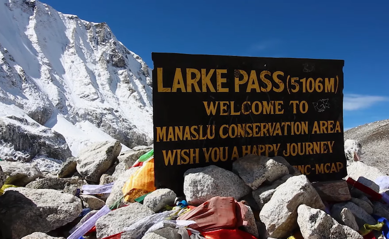
The Larkya La Pass crossing is the most demanding weather-sensitive section of the Manaslu Circuit.
Trekkers normally leave Dharamsala very early in the morning. This is not simply because the morning weather is guaranteed to be perfect. Rather, an early start provides several practical advantages.
It gives the group:
The pass is highly exposed, so wind, snowfall, cloud cover and visibility can be more important than the temperature alone.
It is important not to assume that every early morning is suitable for crossing Larkya La.
Heavy snowfall, strong winds, poor visibility or difficult trail conditions can occur at any time.
Before starting the crossing, trekkers should check the latest conditions with their trekking guide and consider the condition of the trail as well as the forecast.
The goal is not simply to start early; it is to start at the right time for the actual conditions.
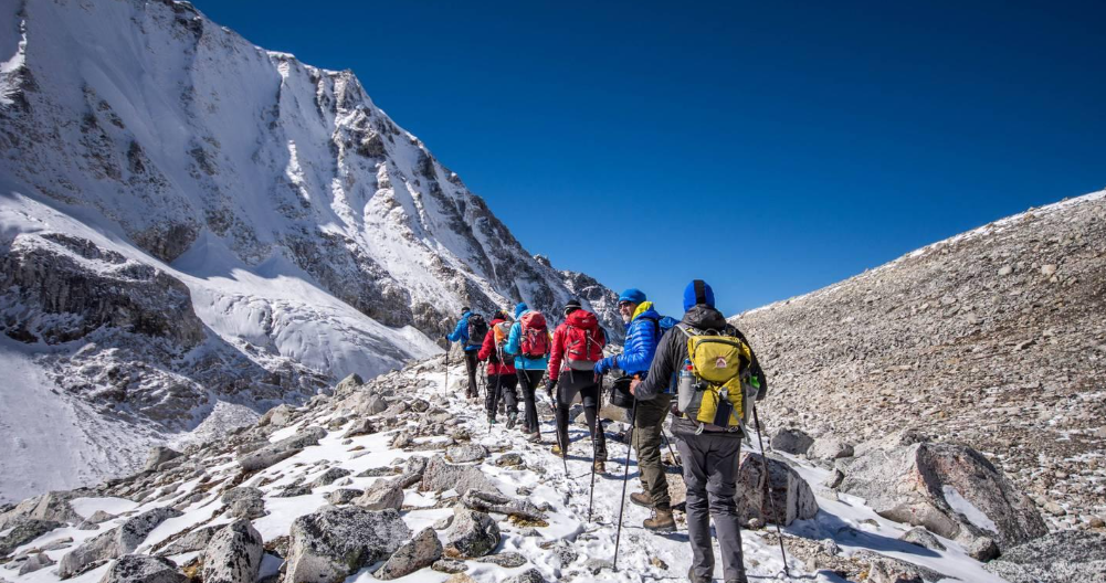
A practical Manaslu trekking routine is to use the morning for longer or more exposed sections whenever conditions are favorable.
For example:
This approach does not guarantee good weather, but it gives trekkers more flexibility if conditions change.
Instead of checking temperature alone, observe several weather factors:
These observations, combined with a reliable forecast and advice from your guide, provide a much better picture of the day’s conditions.
| Time | Common Conditions | What Trekkers Should Do |
|---|---|---|
| Early morning | Cold, often clearer | Dress warmly and start prepared |
| Mid-morning | Warmer, good walking period | Continue trekking and monitor conditions |
| Afternoon | Clouds and wind may increase | Watch changing weather carefully |
| Late afternoon | Cooling temperatures | Aim to reach accommodation |
| Evening | Cold, especially at altitude | Stay warm and prepare for the next day |
There is no universal rule that morning weather is always good and afternoon weather is always bad.
Mountain weather is influenced by season, altitude, valley shape, wind, cloud development and current weather systems.
The practical lesson is simply to use favorable morning conditions wisely, avoid unnecessary delays on exposed terrain, and remain prepared for changes throughout the day.
This becomes especially important above Samagaun and during the approach to Dharamsala and Larkya La, where cold, wind, snow and reduced visibility can have a much greater effect on the trek.
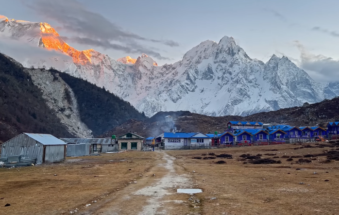
You do not need to become a professional meteorologist to observe useful weather clues.
The most important thing is to watch whether clouds are building, spreading, darkening or remaining stable.
Small white clouds developing around mountain slopes are not necessarily a problem.
They can occur as the landscape warms during the day.
However, rapid vertical growth deserves more attention.
When clouds become widespread and the sky progressively darkens, visibility can deteriorate and precipitation may be approaching.
At higher elevations, precipitation can fall as snow even when lower parts of the route are receiving rain.
Large, rapidly growing storm clouds can indicate unstable conditions.
If thunder, heavy precipitation or strong gusts accompany them, exposed terrain becomes less desirable.
A cloud cap around a major summit does not automatically mean a storm is coming.
However, persistent cloud formation combined with increasing wind or falling visibility can indicate a change in conditions.
The important lesson is:
Do not interpret one cloud in isolation. Watch the trend.
Many trekkers prepare for Manaslu by looking at temperature but underestimate wind.
This becomes increasingly important as you approach Samdo, Dharamsala and Larkya La.
Wind removes heat from the body more quickly, making the air feel colder than the measured temperature.
This is known as wind chill.
For example, a temperature slightly below freezing can feel much harsher when combined with strong wind.
That is why a windproof outer shell is one of the most useful pieces of clothing on the high sections of the Manaslu Circuit.
At high altitude, wind can be a more immediate comfort and safety concern than a small change in air temperature.

Trekkers sometimes check the weather in Samagaun and assume it represents conditions at Larkya La.
It does not.
The two locations have a substantial difference in elevation, and Larkya La is much more exposed.
Between Samagaun and the pass, the route enters progressively colder terrain. By the time you reach Dharamsala and continue toward the pass, vegetation is sparse and shelter from wind becomes limited.
At the pass itself, you may experience:
Therefore, a comfortable afternoon in Samagaun should never be used as proof that the next day’s pass crossing will be comfortable.
Dharamsala, also known as Larkya Phedi, is more than a stopping point before the pass.
It is where trekkers experience the transition into a much colder high-altitude environment.
The temperature can fall considerably after sunset.
The wind can make the campsite or lodge area feel even colder.
This is why your evening preparation matters.
Before going to bed:
You do not want to search through your backpack in freezing darkness at 4 a.m.
Snow does not simply make the trail white.
It can change how quickly and safely you can walk.
Fresh snow may:
The effect depends on the amount and condition of snow.
A thin layer may be manageable.
Deep or wind-packed snow around a high pass can be a very different situation.
This is why current trail information is particularly important after a major snowfall.
Not all snow conditions are equal.
Fresh powder snow can be soft and tiring to walk through.
Compacted snow can become firm and slippery.
Melting snow can create wet, unstable or icy sections.
Refrozen snow can become particularly hard in the early morning.
Consequently, the temperature at night can affect the condition of the trail the following morning.
A cold night may produce firmer surfaces, while daytime warmth can soften snow later in the day.
This is one reason experienced guides pay attention to both the weather forecast and what they see directly on the trail.
The Manaslu Circuit passes through terrain with very different exposure to monsoon moisture.
The lower Budhi Gandaki region can receive substantial rainfall during the summer monsoon.
Higher sections around the Nubri Valley are comparatively sheltered and can be much drier.
This is related to the complex Himalayan terrain and rain-shadow effects.
Therefore, saying “Manaslu is rainy during monsoon” is too simplistic.
A better description is:
The lower circuit is considerably more affected by monsoon rain, while some upper areas experience much drier conditions.
However, reaching those upper areas still requires traveling through the wetter lower sections.
That is one reason monsoon trekking remains logistically challenging despite relatively drier conditions in parts of upper Manaslu.
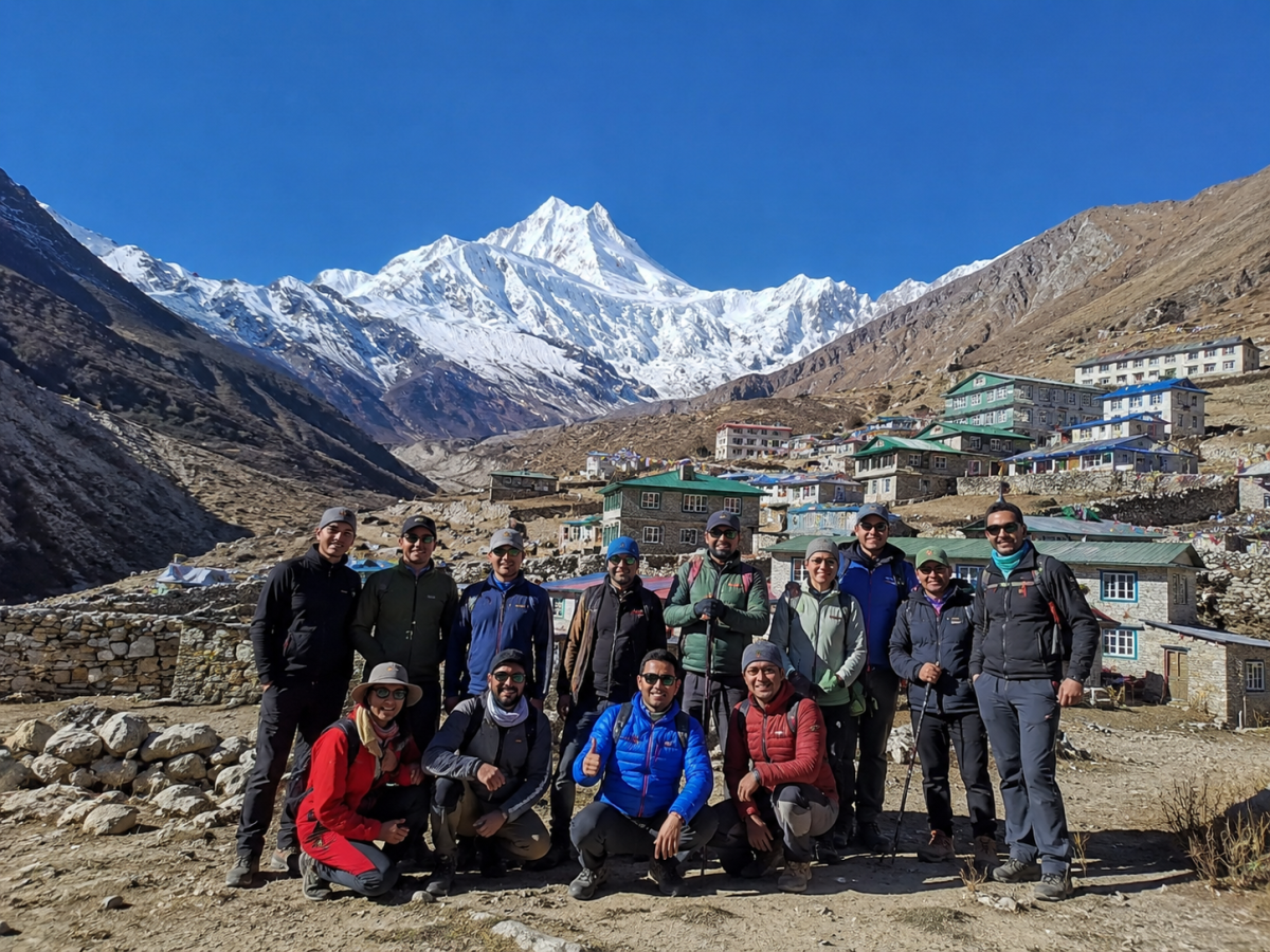
Rain affects more than visibility.
Heavy rainfall can make lower sections:
Road access can also become an important consideration because the Manaslu trekking route begins in an area where seasonal road conditions can change.
For monsoon departures, trekkers should therefore consider the entire journey, not only the weather at their highest trekking destination.
Blue skies are usually welcome, but they do not eliminate all mountain hazards.
At high altitude, clear conditions can mean strong solar radiation.
Trekkers can become dehydrated without realizing it, particularly when the air is dry.
Sun exposure can also be intense.
This means that even on a perfect blue-sky day, you should use:
The cold can also be deceptive.
You may not feel thirsty in cold weather, yet your body still loses fluid through breathing and activity.
One of the noticeable features of weather on the Manaslu Circuit Trek is how quickly the temperature can change between sunny and shaded areas. When you walk on an open, sun-facing section, direct sunlight can make the air feel pleasantly warm, even when the actual temperature is low. However, entering a forest, narrow valley, or shaded trail can make the same area feel much colder within minutes.
Because the trail regularly moves between sunny slopes, forests, valleys, and exposed terrain, it is better to dress in adjustable layers rather than rely on one thick jacket. You can remove a layer while walking in the sun and put it back on when you enter shade or stop for a rest. This simple approach helps you stay comfortable as conditions change throughout the day.
For most trekkers, the coldest conditions are associated with the highest section of the route, particularly:
The exact temperature depends heavily on season and weather.
Rather than relying on one exact number, prepare for sub-freezing conditions during the high-pass crossing, especially during late autumn, winter and early spring.
The combination of low temperature and wind can make the environment feel substantially colder.
The lower Budhi Gandaki Valley is generally the warmest section of the Manaslu Circuit Trek. At the beginning of the route, the trail passes through lower elevations where temperatures are noticeably milder. During spring and early summer, villages such as Machha Khola can feel quite warm, especially when the sun is strong.
As the trek gains elevation, the environment gradually changes from warm river valleys and subtropical landscapes to cooler forests and alpine terrain. The temperature drops noticeably as you approach higher villages, making the contrast between the lower and upper sections of the circuit easy to experience.
This wide temperature range is one of the unique aspects of the Manaslu Circuit Trek. A place like Machha Khola may feel almost tropical compared with the freezing conditions around Larkya La Pass. Therefore, trekkers should prepare for changing temperatures by carrying light, breathable clothing for lower elevations and warm insulating layers for higher sections.
Weather conditions can have a noticeable impact on your walking pace during the Manaslu Circuit Trek. On a dry and stable trail, you can generally maintain your planned pace, but rain may make paths muddy and slippery, while fresh snow can make higher sections more difficult and time-consuming. Strong winds can also increase physical fatigue, particularly on exposed sections of the route.
Poor visibility is another factor that may require trekkers to slow down and pay closer attention to the trail. For this reason, it is better to treat daily walking times as estimates rather than fixed schedules. A well-planned Manaslu itinerary should allow some flexibility for changing weather, trail conditions, and unexpected delays.
Weather and altitude create different challenges, but they can affect your trekking experience together. Cold conditions may disturb sleep, while strong winds and snow can increase fatigue and make walking harder. In dry, cold air, trekkers may also drink less water without realizing it, increasing the risk of dehydration.
At higher elevations, your body is already working harder to adjust to reduced oxygen levels. Even when the sky is clear and conditions look comfortable, proper acclimatization remains essential. Good weather does not mean your body has fully adapted to altitude.
There is no single universal temperature at which the pass becomes “safe” or “unsafe.”
The decision depends on several factors:
A professional trekking guide should consider these factors together rather than relying on a single weather-app number.
If conditions are deteriorating, the safest decision may be to delay, adjust the itinerary or turn back.
The evening at Dharamsala is an important time to review the conditions before crossing Larkya La Pass the following morning. Rather than focusing only on temperature, check the factors that can directly affect safety, walking time, and trail conditions.
These questions provide a more practical picture of the Larkya La Pass crossing than simply asking, “What will the temperature be?”
Weather apps can be helpful during the Manaslu Circuit Trek, but they should be treated as one source of information rather than the final authority. Mountain weather can change quickly, and forecast models may not fully reflect conditions around steep valleys, high passes, and exposed terrain.
When checking a forecast, focus on the conditions that matter most for trekking:
Apps and websites such as Windy, Mountain-Forecast, Yr, and AccuWeather can provide useful forecast information. Windy is particularly helpful for viewing wind, precipitation, cloud cover, and weather patterns, while Mountain-Forecast can provide elevation-specific forecasts for mountain areas.
However, forecast information should always be compared with your trekking guide’s observations and local conditions. A forecast for a lower settlement may not accurately represent weather near Larkya La at more than 5,000 meters.
Practical tip: Check forecasts while you have a reliable internet connection and save important information for offline access where possible. Before leaving for remote sections, confirm the latest conditions with your guide, lodge staff, or other trusted local sources.
People who live and work along the Manaslu Circuit Trek experience the mountain environment every day. Experienced guides, porters, lodge owners, and local residents can often recognize changes in clouds, wind, snowfall, and trail conditions that may not be obvious from a general weather forecast alone. Their familiarity with the route can provide valuable practical information.
However, local knowledge should complement rather than replace modern forecasts. The most reliable approach is to consider the weather forecast, local information, direct observation, and professional judgment together. Combining these sources can help trekkers better understand changing conditions and make safer, more practical decisions on the trail.
Some changes deserve immediate attention.
Be more cautious when you notice:
Weather-related decisions should always prioritize safety over completing the itinerary exactly as planned.
Two principles work particularly well on the Manaslu Circuit.
Early starts can provide:
This is particularly useful on the Larkya La crossing day.
Do not build an itinerary so tightly that one unexpected weather event ruins the entire schedule.
A flexible itinerary allows your guide to make sensible decisions when conditions change.
For a travel website, I would make the heading more search-friendly, scannable, and natural, while avoiding a repetitive “season = weather” style. Here is a polished version:
Understanding the Manaslu Circuit weather by season is essential when choosing the right time for your trek. Conditions change considerably as the route rises from the lower Budhi Gandaki Valley toward the high-altitude Larkya La Pass (5,160 m). Each season brings different temperatures, rainfall, snowfall, trail conditions, and mountain visibility.
Spring is one of the best seasons for the Manaslu Circuit Trek, with gradually warming temperatures and generally improving trail conditions. March can still feel wintry at higher elevations, where snow and cold mornings may remain. April usually offers a good balance of comfortable temperatures, clearer mountain views, and stable trekking conditions. By May, warmer temperatures arrive, although clouds and occasional pre-monsoon showers become more likely toward the end of the month.
The monsoon season brings more rainfall to the lower sections of the Manaslu Circuit, resulting in muddy trails, slippery paths, landslide risks, and possible transportation delays. Higher areas can receive less rainfall than the lower valleys, but changing conditions can still affect the overall trek. Late September often becomes more favorable as monsoon weather gradually retreats and clearer mountain conditions begin to return.
Autumn is widely considered the best season for the Manaslu Circuit Trek because post-monsoon conditions often provide clear skies, good visibility, and comfortable trekking temperatures. October is particularly popular for its generally stable weather and excellent Himalayan views. November can still offer good trekking conditions, but temperatures begin to fall noticeably, especially during mornings, evenings, and at higher elevations.
Winter brings the coldest conditions to the Manaslu region, with freezing temperatures and increased chances of snow and ice at higher elevations. Heavy snowfall can make the Larkya La Pass more difficult to cross and may affect trail accessibility. Lower sections can remain manageable, but winter trekking requires appropriate cold-weather equipment, careful planning, and greater flexibility. This season is generally more suitable for experienced trekkers prepared for severe high-altitude conditions.
Instead of packing around a specific forecast, prepare for a wide temperature range.
Bring:
Add:
You should have:
Your cold-weather equipment should be capable of handling:
The golden rule is:
Prepare for the high point of the trek, not the starting point.
Before leaving your lodge each morning, ask five questions:
Look at the sky, wind and visibility.
Was there rain, snow or a major temperature drop?
Check precipitation, wind and visibility forecasts.
Do not assume conditions are identical higher on the trail.
Combine forecast information with local trail knowledge.
This simple system is much more useful than checking only the temperature.
| Weather Factor | What It Can Mean |
|---|---|
| Clear morning | Often good visibility, but continue monitoring |
| Rapid cloud buildup | Possible changing conditions |
| Strong wind | Greater cold exposure, especially at high altitude |
| Fresh snowfall | Slower and potentially more difficult trail |
| Heavy lower-valley rain | Mud, slippery trails and possible landslide concerns |
| Falling visibility | Navigation and route-finding become harder |
| Clear high-altitude sky | Strong sun exposure; protect eyes and skin |
| Freezing overnight | Icy or firmer snow conditions in the morning |
| Persistent storm | Consider delaying exposed sections |
The Manaslu Circuit Trek weather is not defined by one temperature or a single forecast. Conditions change continuously as the trail climbs from warm lower valleys through cool forests, high mountain villages, the dry upper Nubri region, and finally to the cold, exposed terrain around Larkya La Pass.
Altitude, wind, sunlight, clouds, snowfall, time of day, and actual trail conditions can all influence your trekking experience. A weather app is useful, but understanding these factors and listening to local advice is even more important.
For Safe Holiday Adventure trekkers, the best approach is simple: choose the right season, prepare for the coldest section, begin high-altitude crossings early, follow your guide’s advice, and remain flexible when Himalayan weather changes. Good preparation does not mean expecting perfect weather—it means being ready for whatever the mountain brings.
The goal is not to defeat the weather. The goal is to understand it well enough to trek safely through it.
No. The route crosses several elevation and climate zones. Lower sections are warmer and more humid, while Samagaun, Samdo, Dharamsala and Larkya La are progressively colder and more exposed.
Larkya La is significantly higher and more exposed to wind. Wind chill, altitude and the absence of shelter can make conditions feel much colder.
Yes. Conditions can change as the landscape warms, clouds develop and winds increase. This is one reason early starts are commonly used for longer and more exposed sections.
Yes. Temperatures can fall rapidly after sunset, especially above 3,000 meters. Nights around Samdo and Dharamsala can be particularly cold.
Yes. Snow can remain from winter, and new snowfall is also possible depending on the weather system and time of year.
Yes. The lower Budhi Gandaki Valley is considerably more affected by monsoon rainfall than some of the upper Manaslu areas.
Mountain terrain creates local differences in temperature, wind, cloud and precipitation. A forecast for a lower settlement may not accurately represent conditions at a 5,000-meter pass.
Both matter. Wind can significantly increase heat loss and make sub-freezing conditions feel considerably colder.
Tell your guide immediately, avoid continuing into dangerous exposed terrain, and follow the group’s safety plan. If necessary, delay or modify the itinerary rather than taking unnecessary risks.
For most trekkers, autumn (October–November) and spring (March–May) provide the most favorable overall conditions. October is particularly popular for stable weather and mountain visibility.
Safe Holiday Adventure is a Nepal-based trekking company specializing in Himalayan trekking and adventure travel. If you are planning the Manaslu Circuit, our team can help you select the right season, prepare for high-altitude weather and organize an itinerary with appropriate acclimatization and flexibility.
Your Manaslu adventure should be planned around the mountain—not just the calendar.
There is a moment on every Everest trek when your legs have an opinion. For most people, it arrives
Continue Reading
If you are asking how difficult the Everest Three Passes Trek is, the honest answer is this: it is t
Continue Reading
My name is Peng Chang, and I travelled to Nepal from Malaysia with a small group of friends. Before
Continue Reading
In this story Why I Chose Everest Base Camp My name is Chyling, and I come from Malaysia, a country
Continue Reading
Ask anyone who has finished the Annapurna Circuit which day they remember most, and the answer is al
Continue Reading
Introduction Kathmandu doesn’t ease you in. You step out of the airport into a chorus of horns
Continue Reading