
29 Jan 2020 12 min to read
There are treks that give you one great view, and then there is the Annapurna Circuit Trek. Over a couple of weeks you leave behind humid rice terraces, climb through pine forest and glacier-fed valleys, cross a 5,416 m pass, and drop into a dry, wind-carved canyon where the mountains look completely different. Few trails in the world change this much from day to day.
The route loops around the Annapurna massif in central Nepal. Most trekkers start in or around Besisahar or Dharapani, since jeep roads now cover the lowest stretches, and finish at Jomsom, Tatopani or Nayapul before heading to Pokhara. Depending on how much road you skip and how many side trips you add, the trek takes roughly 10 to 18 days. You sleep in family-run teahouses, eat dal bhat, and walk between villages that have been trading routes for centuries.
This guide covers the eight places that define the trek, along with the practical details that help you enjoy each one.
In this guide:

The first days of the Annapurna Circuit Trek follow the Marshyangdi River, and you hear it long before you see it. Milky blue water pounds through narrow gorges, waterfalls fall from the cliffs, and long suspension bridges sway above the current. Terraced farms, banana trees and small Gurung and Magar villages line the lower trail.
As you gain height, the world shifts. Rhododendron and oak give way to pine and fir, the air turns cool, and the valley opens near Chame and Pisang. On clear mornings Annapurna II appears above you, and for the first time you feel the scale of the mountains ahead.
Good to know: These early days are mild, so use them to find your rhythm. Walking slowly now saves your energy above 3,500 m. Where the road runs alongside the trail, many trekkers jump ahead by jeep and spend more time on the quieter stretches higher up.

At 3,540 m, Manang is where the trek turns serious. Stone houses with flat roofs, long mani walls and bakeries serving apple pastry sit beneath the icefalls of Annapurna III and Gangapurna. It is also where trekkers pause for an acclimatization day, which is the single smartest decision you can make on this route.
The rule is simple: climb high, sleep low. Spend your free day hiking up to Gangapurna Lake, the viewpoint above the village, or toward Ice Lake, then return to Manang to sleep. Your body learns to cope with thinner air, and your chances of altitude sickness drop sharply.
If you have extra days and good fitness, the trek to Tilicho Lake (4,919 m) is one of the best side trips in Nepal. The path is steep and exposed in places, so it needs good weather and a steady head, but the turquoise lake below ice walls is unforgettable.
Good to know: Manang has a small health post that gives talks on altitude sickness most afternoons. They are worth attending.
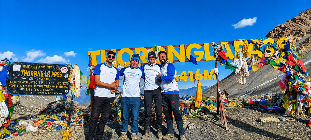
Every trekker remembers their Thorong La morning. You wake around 3 or 4 a.m. at Thorong Phedi or High Camp, pull on every layer you own, and set out under a sky full of stars. The climb is slow and steady, your breath is loud, and your fingers freeze despite the gloves.
Then, near 5,416 m, you reach the prayer flags. The wind snaps at them, strangers hug, and the first sun lights up peaks you have walked beside for days. It is a quiet, emotional moment, and it is easy to see why this crossing is the heart of the trek.
The descent is long, around 1,600 m down to Muktinath, and it is hard on the knees. Poles help a lot.
Good to know: Start early, because winds rise by late morning. Any serious headache, confusion or loss of balance means you go down, never up. The pass is dangerous in bad weather, so always check conditions with your guide or lodge owner.
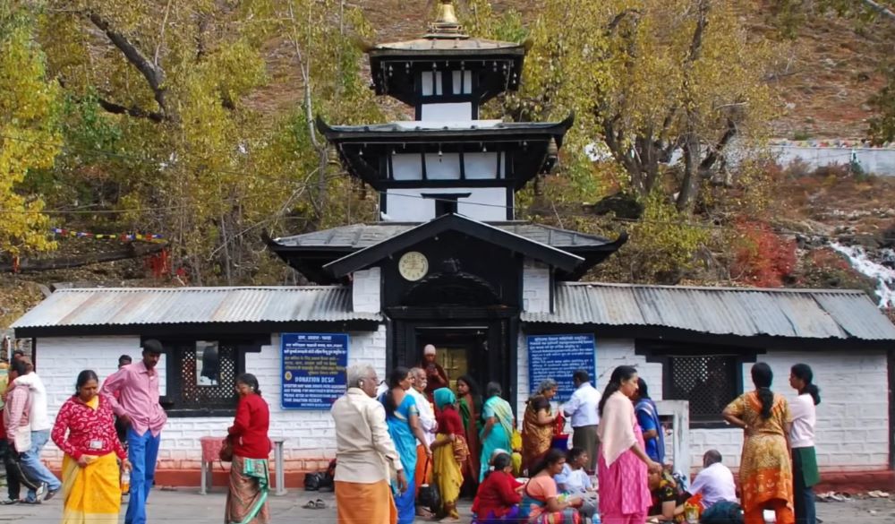
After the cold of the pass, Muktinath (3,710 m) feels like a different planet. The sun is warmer, the air is dry, and the mood is peaceful. This is one of the holiest places in Nepal, sacred to Hindus and Buddhists alike.
Pilgrims walk under 108 stone water spouts and bathe in the icy streams, then pray at the Vishnu temple. Close by is the small Jwala Mai shrine, known for a flame that burns beside a spring. Many pilgrims see it as a sign of the sacred, and it is moving to watch them arrive after long journeys, some on foot, some by horse, all with offerings.
Good to know: Visit in the early morning, when it is quiet and the light is soft. Dress modestly and remove your shoes where asked.
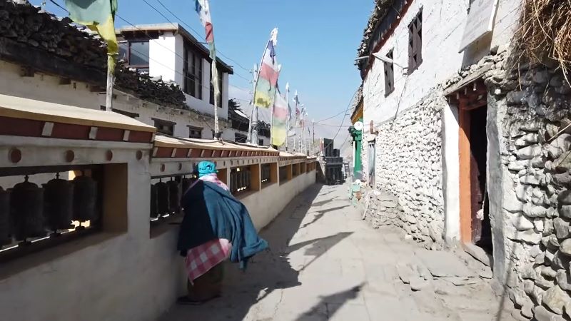
An easy walk or jeep ride from Muktinath brings you to Kagbeni (2,810 m), and it looks like another age. Narrow, shaded lanes run between mud-brick houses, prayer wheels turn beside the paths, and a red-walled monastery watches over the village. Behind it, the barren valley stretches north toward Upper Mustang.
Kagbeni sits where two rivers meet, so the winds here can be strong, especially in the afternoon. Walk to the northern edge of the village and look up the valley. It is a quiet reminder of how close you are to the old Tibetan-style kingdom beyond.
Good to know: The standard circuit does not need a special permit for Kagbeni. Going on into Upper Mustang does, and that is a separate trek.

The trail now runs down the Kali Gandaki Gorge, one of the deepest river valleys on Earth, with Dhaulagiri (8,167 m) on one side and Annapurna I (8,091 m) on the other. Strong winds funnel up the valley most afternoons, so walk early and enjoy the views before the dust rises.
Jomsom (about 2,720 m) is the busy hub of the valley, with shops, lodges, a bank and a small airport. If your time is short, this is where many trekkers fly back to Pokhara. For everyone else, a few kilometers south is Marpha, probably the best village on the whole circuit.
Marpha’s whitewashed stone lanes, wooden window frames and hillside monastery make it look like a painting. It is also apple country: orchards surround the village, and the bakeries and cafes sell apple pie, hot cider and local apple brandy. After a week of dal bhat, the food here feels like a feast.
Good to know: Flights from Jomsom can be delayed by wind or cloud, so keep a spare day if you plan to fly out.
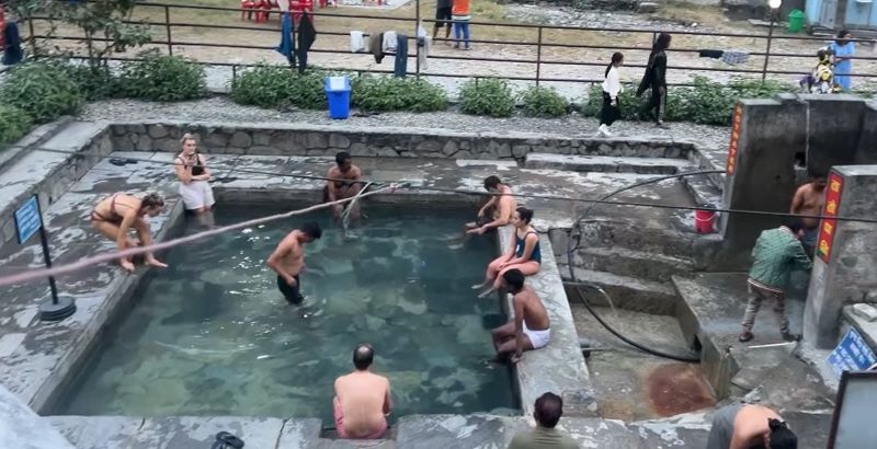
“Tatopani” simply means “hot water,” and it is the most welcome name on the whole trail. After days of walking, soaking in the riverside hot springs soothes your muscles and clears your head. The air is warm, the lodges are surrounded by orange trees, and the contrast with the cold above makes the village feel almost tropical.
Tatopani is also a decision point. You can leave by jeep for Pokhara, or keep walking up to Ghorepani, a steady climb of about a day, for the sunrise view over Dhaulagiri and Annapurna from Poon Hill. Many trekkers add it as a final highlight.
Good to know: The springs are busiest in the afternoon. Go in the early morning or just after sunset for a quieter soak.
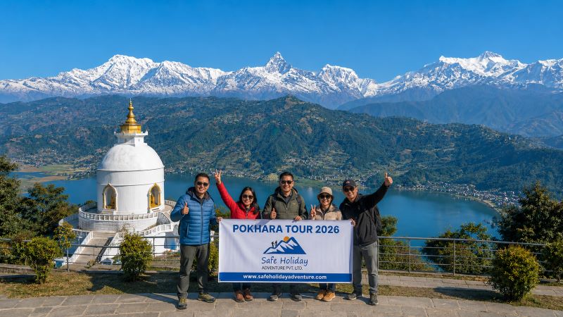
The trek ends in Pokhara, where the Annapurna range rises behind Phewa Lake like a painted backdrop. After two weeks of teahouse beds and cold mornings, a hot shower, a cold drink and a lakeside restaurant feel like pure luxury.
Spend a day on a rowboat, watch the sun set from the World Peace Pagoda, or try paragliding for a bird’s-eye view of the mountains. If you have more time, the jungles of Chitwan National Park are a short trip away, with rhinos, deer and rich birdlife.
Autumn (October to November) is the most popular season, with clear skies, stable weather and sharp mountain views. Spring (March to May) brings blooming rhododendrons and warmer days, though afternoon clouds are more common. Summer monsoon is possible because the upper section lies in a rain shadow, but the lower trail is wet, muddy and leech-prone. Winter is cold, with heavy snow and a real risk of pass closures.
All trekkers need an Annapurna Conservation Area Permit (ACAP), available in Kathmandu or Pokhara. The TIMS card requirement has been unclear in recent seasons, so confirm the current rule with your trekking agency before you travel. No restricted area permit is needed for the standard circuit.
The circuit is not technical, but it is demanding. The challenges are altitude, long days and changing weather, not difficult terrain. Build in the Manang rest day, drink plenty of water, and walk slowly. Most healthy trekkers with moderate fitness can complete it with good preparation.
Layers matter more than anything else: a down jacket, thermal base layers, a waterproof shell, warm gloves and a hat for Thorong La. Add sturdy broken-in boots, trekking poles, a headlamp, sunscreen, sunglasses and a water bottle. A sleeping bag is useful even though teahouses supply blankets.
What makes the Annapurna Circuit special is not one single viewpoint. It is the way the trail keeps changing: green valleys, glacier lakes, a high pass, a sacred temple, an apple-scented village, and a hot spring to finish. Give yourself enough days, respect the altitude, and the circuit will repay you in memories.
Planning your Annapurna Circuit Trek? Contact Safe Holiday Adventure to build a custom itinerary that fits your time, fitness and budget.
1. What are the top places to visit in Annapurna Circuit Trek?
The top eight are Marshyangdi Valley, Manang, Thorong La Pass, Muktinath, Kagbeni, Jomsom and Marpha, Tatopani, and Pokhara.
2. How many days does the Annapurna Circuit Trek take?
Most itineraries take 10 to 18 days, depending on how much road you skip and which side trips you add.
3. How long is the Annapurna Circuit Trek?
The route is roughly 160 to 230 km, depending on where you start and finish.
4. What is the highest point on the trek?
Thorong La Pass, at 5,416 m.
5. Where does the Annapurna Circuit Trek start and end?
Most trekkers start around Besisahar or Dharapani and finish at Jomsom, Tatopani or Nayapul before heading to Pokhara.
6. How difficult is the Annapurna Circuit Trek?
It is moderate to challenging. The terrain is not technical, but altitude, long days and weather make it demanding.
7. Can beginners do the Annapurna Circuit?
Yes, if they are reasonably fit and allow time to acclimatize. Walk slowly and never skip the rest day in Manang.
8. When is the best time to trek?
October to November and March to May have the clearest skies and the most stable weather.
9. Can I trek the Annapurna Circuit in monsoon?
Yes, because the upper section lies in a rain shadow, but the lower trail is muddy and leech-prone.
10. Is altitude sickness a risk?
Yes, especially near Manang and Thorong La. Climb gradually, drink plenty of water, and descend if symptoms get worse.
11. Why do trekkers stay two nights in Manang?
The extra day helps your body adjust to thinner air. Hike up during the day, then return to sleep lower.
12. Is Tilicho Lake worth the extra days?
Yes, if you are fit and the weather is good. It sits at 4,919 m and is one of the most beautiful side trips on the route.
13. What permits do I need?
You need the Annapurna Conservation Area Permit (ACAP). The TIMS card rule has been unclear in recent seasons, so confirm it with your agency.
14. Do I need a guide or porter?
Not by law on this route, but a guide helps with safety and weather decisions, and a porter makes long days easier.
15. What are teahouses like on the circuit?
They are simple family-run lodges with basic rooms and shared bathrooms. Meals are available in every main village, and dal bhat is the standard choice.
16. Is there phone signal and Wi-Fi?
Mobile signal and paid Wi-Fi are available in many villages, but they get weaker at higher altitudes and in bad weather.
17. What should I pack for Thorong La?
Bring a down jacket, thermal layers, waterproof shell, warm gloves, a hat, a headlamp and trekking poles.
18. Can I fly out of Jomsom?
Yes. Flights to Pokhara run from Jomsom, but wind and cloud can cause delays, so keep a spare day.
19. Can I add Poon Hill after Tatopani?
Yes. Ghorepani and Poon Hill are about a day’s climb from Tatopani and add a sunrise view over Dhaulagiri and Annapurna.
20. Is the Annapurna Circuit Trek safe?
Yes, with good preparation. Acclimatize properly, check weather before crossing the pass, and carry travel insurance that covers high-altitude trekking and evacuation.

In this story Why I Chose Everest Base Camp My name is Chyling, and I come from Malaysia, a country
Continue Reading
Ask anyone who has finished the Annapurna Circuit which day they remember most, and the answer is al
Continue Reading
Introduction Kathmandu doesn’t ease you in. You step out of the airport into a chorus of horns
Continue Reading
Every Everest Base Camp trekking package includes a line item for “guide” and “por
Continue Reading
Understanding Everest Base Camp Trek Permits Cost is one of the first things every Everest Region tr
Continue Reading
Introduction Namche Bazaar is the beating heart of the Khumbu region and the first major stop for ev
Continue Reading