
6 Feb 2020 17 min to read
The Annapurna Circuit Trek in Monsoon is not the trek most guidebooks sell you, and that is exactly why some travelers love it. From June to August, the lower valleys turn emerald, waterfalls pour off every cliff, and the trail is so quiet you can hear your own footsteps. The price is rain, leeches, slippery paths and clouds that hide the big peaks for days at a time.
So is the Annapurna Circuit Trek in Monsoon a smart choice or a risky one? This guide gives you an honest answer: what the weather is really like, which sections are tricky, how to adjust the itinerary, what to pack, and who should skip it.
| Detail | Monsoon Reality |
|---|---|
| Season | June to August (rain can linger into early September) |
| Duration | 14–17 days, with spare days for delays |
| Highest point | Thorong La Pass, 5,416 m |
| Difficulty | Moderate to hard, harder when wet |
| Crowds | Very light |
| Main challenges | Rain, leeches, landslides, cloud, flight delays |
| Best for | Experienced, flexible trekkers who love green landscapes and solitude |

The monsoon arrives in Nepal from the Bay of Bengal, usually reaching the country around early-to-mid June and fading by September. Rain is heaviest in July and August, often falling in the afternoon and at night, with mornings that can be surprisingly clear.
The circuit is unusual because it crosses two different climate zones, and this matters a great deal for anyone planning the Annapurna Circuit Trek in Monsoon.
The wet side (Besisahar to Chame). The eastern approach is humid, steep and densely forested. It takes the full force of the monsoon, which means heavy rain, landslide risk and leeches.
The rain-shadow side (Manang, Thorong La and Mustang). Beyond the main Himalayan wall, the landscape turns dry and high-desert. These areas receive far less rain, which is why monsoon trekkers often say the best part of the trip begins once they pass Chame.
That split personality is the secret of trekking this route in summer: you suffer through the wet start, then enjoy a much drier middle and finish.
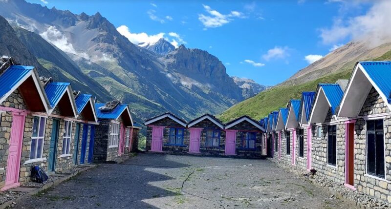
Rice terraces glow bright green, rivers roar with snowmelt and rain, and villages sit under floating mist. If you prefer drama and color over postcard-blue skies, this season delivers.
In October, the circuit can feel like a highway. In July, you may share a teahouse with just a handful of other guests. Owners have time to talk, and the experience feels more personal.
You rarely need to rush for rooms, and some lodges offer flexible rates in the low season. That is a real advantage on the high-altitude stretch where beds fill quickly in autumn.
Rain washes the dust away. Many slopes bloom with wildflowers, and the air feels clean and cool, especially higher up.
Manang and the area around Thorong La sit in the rain shadow, so conditions there are often better than on the way up. Mornings at high altitude can be crisp, bright and rewarding.
Being honest about the downsides is the best way to plan a safe Annapurna Circuit Trek in Monsoon.
None of these risks is a reason to panic, but all of them are reasons to plan carefully and stay flexible.
Early June can still feel like late spring, with warm days and occasional pre-monsoon storms. Rain builds through the month. This is the gentlest time to try the Annapurna Circuit Trek in Monsoon, and the high sections are often more comfortable than later in summer.
July is typically the wettest month. Lower sections are muddy, leeches are at their peak, and landslide risk is highest. Choose July only if you are experienced, have flexible dates, and are happy to trek with a guide.
August remains rainy, but late in the month you may notice more breaks in the clouds. Mountain views can begin to return, and the greenery is at its most vivid. It is a good option for photographers who love moody skies.
If your schedule allows, many guides consider late August or early September a better compromise than the middle of July.
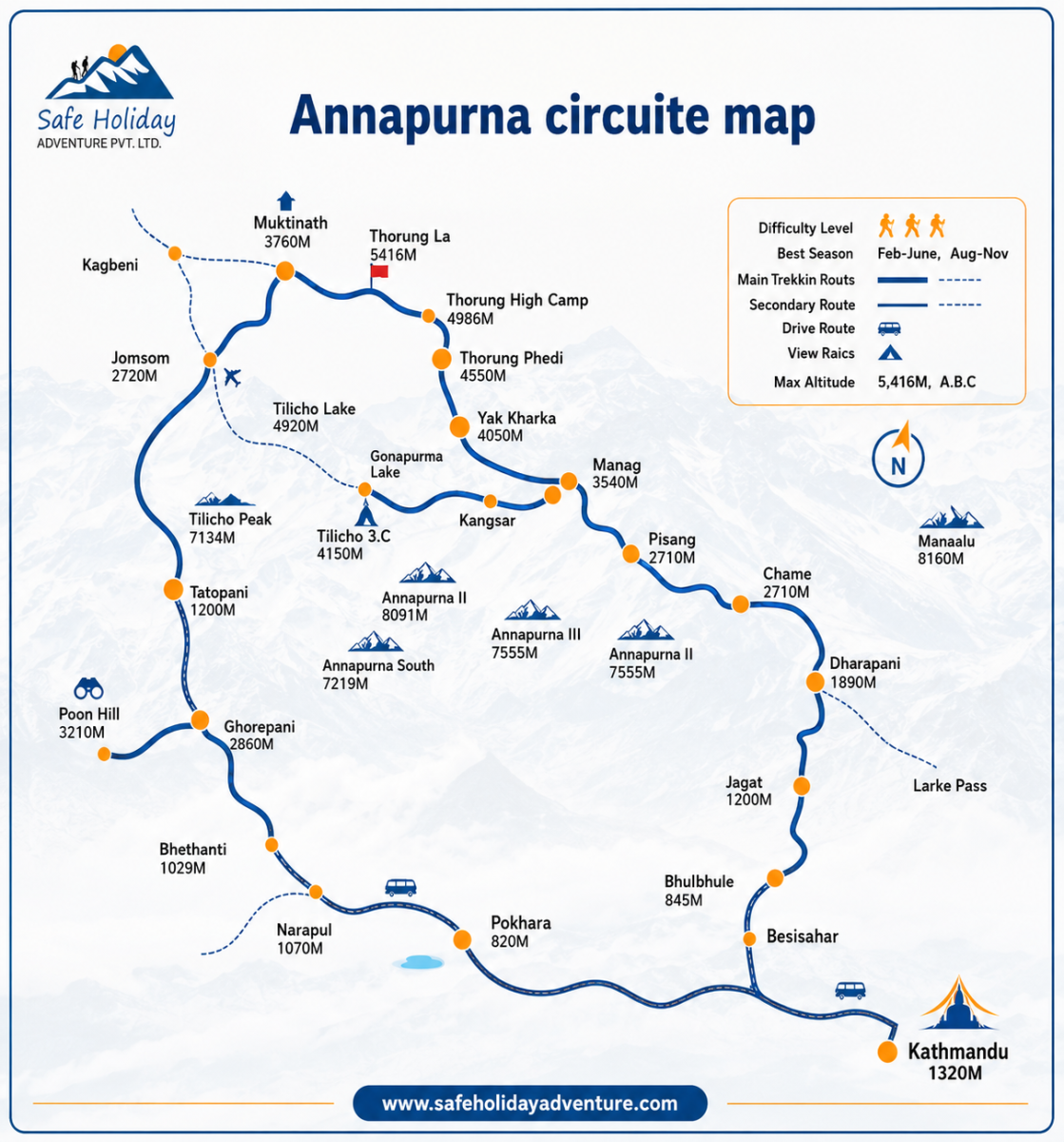
This plan keeps the classic route but adds flexibility for rain, landslides and flight delays. Walking times are approximate and change with pace, trail condition and weather. Altitudes are rounded.
| Day | Route | Sleep Altitude | Walking Time |
|---|---|---|---|
| 1 | Kathmandu → Besisahar → Bhulbhule | 840 m | Drive 6–8 hrs, walk 30–60 min |
| 2 | Bhulbhule → Jagat | 1,300 m | 5–6 hrs |
| 3 | Jagat → Dharapani | 1,860 m | 6–7 hrs |
| 4 | Dharapani → Chame | 2,710 m | 5–6 hrs |
| 5 | Chame → Lower Pisang | 3,200 m | 5–6 hrs |
| 6 | Pisang → Manang | 3,540 m | 5–7 hrs |
| 7 | Acclimatization in Manang | 3,540 m | 3–4 hrs (optional hike) |
| 8 | Manang → Yak Kharka | 4,018 m | 3–4 hrs |
| 9 | Yak Kharka → Thorong Phedi | 4,450 m | 3–4 hrs |
| 10 | Thorong Phedi → Thorong La → Muktinath | 3,760 m | 8–10 hrs |
| 11 | Muktinath → Kagbeni → Jomsom | 2,720 m | 5–7 hrs |
| 12 | Jomsom → Marpha | 2,670 m | 2–3 hrs |
| 13 | Marpha → Tatopani | 1,190 m | 3–5 hrs walk plus jeep |
| 14 | Tatopani → Beni → Pokhara | 820 m | Jeep and bus, 6–8 hrs |
| 15 | Buffer day or return to Kathmandu | 1,400 m | Drive 6–7 hrs or flight 25 min |
Leave Kathmandu by 6:30 am. The road follows the Trishuli and Marsyangdi rivers, and monsoon landslides can cause delays, so a very early start matters. From Besisahar, a short jeep ride or walk takes you to Bhulbhule. Expect warm, humid air and your first views of green terraces. Monsoon note: start checking your boots and socks for leeches from today.
The trail climbs beside the Marsyangdi through Ngadi, Bahundanda and Syange, with waterfalls and suspension bridges. Steep stone steps are slippery in rain. Monsoon note: this section is among the most landslide-prone, so ask your guide to check recent trail reports. A jeep for part of the way is a sensible option.
You pass Chamje and Tal, where the valley widens and a long waterfall drops into the village. After Tal the landscape turns more Tibetan in style, with mani walls and prayer flags. Monsoon note: leeches are still common in the forested stretches, so use gaiters and repellent.
You walk through pine and oak forest via Bagarchhap, Danaque and Timang. Chame is the district headquarters of Manang, with a bank, small shops and a hot spring across the river. From here, rain begins to ease because you enter the rain-shadow zone. Monsoon note: trails are often drier from this point, and mountain views start to appear in the mornings.
The valley narrows beneath the huge curved rock wall of Paungda Danda. You cross the river at Bhratang and walk through apple-scented forest to Pisang. On a clear day, Annapurna II and Pisang Peak glow in the late light. Altitude note: you are above 3,000 m now, so drink plenty of water.
The upper route through Ghyaru (3,670 m) and Ngawal (3,660 m) gives the best views and helps with acclimatization. The lower route is flatter and safer if the weather is poor. Both lead to Manang, a lively village with a bakery, a small cinema and good food. Monsoon note: choose the lower route if clouds are heavy or the trail is slippery.
Never skip this day. Pick one of these:
Attend the local altitude talk if it is running, and keep your meals light and your fluids high.
The trail climbs slowly through open meadows with grazing yaks and blue sheep if you are lucky. The air is thin, so walk at a gentle pace. Monsoon note: afternoon clouds roll in quickly, so reach the lodge early.
You pass Ledar and cross a wooden bridge before a steep climb to Phedi, a small cluster of lodges below the pass. Rest in the afternoon, eat well and prepare your headlamp, warm layers and snacks. Sleeping at Phedi (rather than High Camp at about 4,900 m) is generally better for acclimatization, particularly if you feel any symptoms.
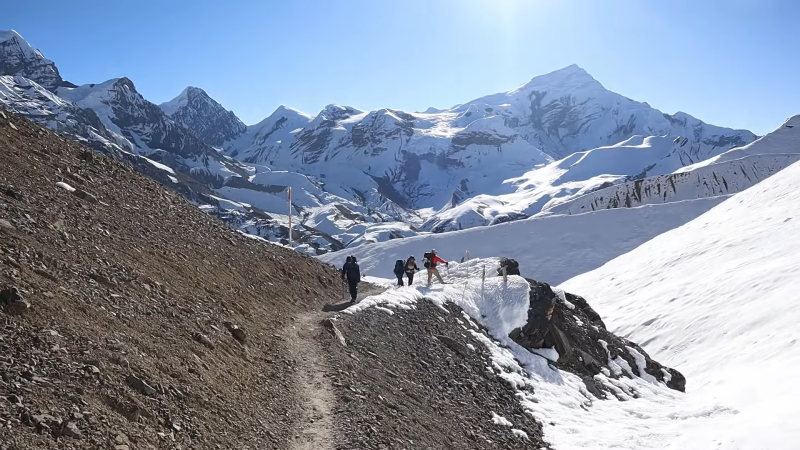
This is the biggest day of the Annapurna Circuit Trek in Monsoon. Start around 4:00–5:00 am. Mornings are usually calmer and clearer, while winds and clouds build later. The climb to Thorong La takes about 4–5 hours, followed by a long, knee-testing descent of 4–5 hours to Muktinath. Carry water, snacks, warm gloves and a hat. Monsoon note: the pass is generally snow-free in summer, but cold, wind and cloud still matter. Turn back if weather or symptoms worsen.
Visit the Muktinath temple early, then descend into the dry, windy Kali Gandaki valley. Kagbeni is a medieval-style village on the edge of Upper Mustang. Strong winds begin by late morning, so many trekkers take a jeep for part of the way. Monsoon note: this side gets far less rain, so the trail is usually in better condition.
A short and gentle day. Marpha is a neat whitewashed village famous for apples, apple cider and fresh apple pie. Visit the Marpha monastery and spend the afternoon resting your legs. This day also works as a weather buffer if flights or roads are disrupted.
Most trekkers use a jeep for the long road section and walk selected stretches through Tukuche, Larjung or Kalopani. Tatopani means “hot water,” and its natural hot springs are the perfect reward for tired legs. Monsoon note: landslides are common on the road, so keep this day flexible and travel early.
Road conditions can be rough in wet weather, so allow extra time. In Pokhara, celebrate with lakeside views, a hot shower and a proper meal.
Keep this day free as insurance for delays. If everything goes smoothly, take a morning flight or bus back to Kathmandu.
Rain doesn’t change how altitude affects your body, but wet clothes, cold, poor sleep and fatigue can make symptoms feel worse and harder to spot. The upper Manang side sits in a rain shadow, so it is often drier than the lower trail. The risk is still real, especially around Thorong La Pass (5,416 m).
Mild symptoms mean you should stop climbing and rest at the same altitude. If they don’t improve in 24 hours, or if they get worse, go down.
Descend at once, even at night, and arrange evacuation if needed. Never leave a sick trekker alone.
Bottom line: altitude sickness depends on how fast you climb, not on how fit you are. A turned-back trek is better than a medical emergency.
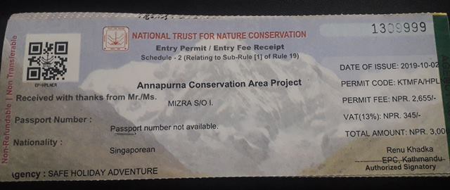
For the Annapurna Circuit, you generally need the Annapurna Conservation Area Permit and, depending on the current rules, other local permits or trekker registration. Fees and requirements change from time to time, so always confirm the latest information with your trekking agency before you travel.
As a rough guide, budget for permits, transport, accommodation, food, guide or porter services, and some extra money for delays. Monsoon trips can cost slightly less because of low-season pricing, but it is wise to keep a reserve for jeeps, extra nights or emergency flights.
On a clear autumn day, many experienced trekkers feel comfortable alone. In monsoon, a guide is a much stronger idea. A local guide can judge the safety of a crossing, choose alternative routes, manage leeches and weather, and arrange transport when trails close. A porter also makes the wet sections far more comfortable, because rain-soaked packs become surprisingly heavy.
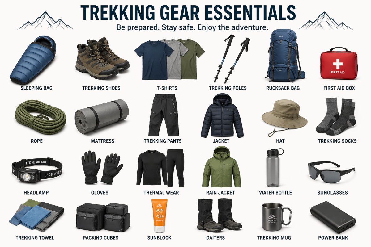
Waterproofing and quick-drying layers matter more than anything else.
Rain protection
Clothing
Footwear
Leech and insect defense
Essentials
| Season | Weather | Views | Crowds | Verdict |
|---|---|---|---|---|
| Spring (Mar–May) | Warm, flowers | Good | Busy | Excellent |
| Monsoon (Jun–Aug) | Wet, humid | Cloudy | Very light | Challenging but rewarding |
| Autumn (Sep–Nov) | Clear, stable | Best | Very busy | Ideal |
| Winter (Dec–Feb) | Cold, snow risk | Sharp | Light | Difficult at high altitude |
If you want perfect views, choose autumn or spring. If you want quiet trails and a more adventurous feel, the Annapurna Circuit Trek in Monsoon can be a memorable alternative.
It suits you if you:
Consider another season or route if you:
If you still want a monsoon adventure with less risk, consider rain-shadow treks like Upper Mustang or Nar Phu, or choose a shorter Annapurna route.
1. Can you trek the Annapurna Circuit in monsoon?
Yes. The trail stays open from June to August, but expect rain, leeches and slippery paths on the lower sections.
2. Is the Annapurna Circuit dry in monsoon?
Not fully. Manang and Mustang sit in a rain shadow and get much less rain than the lower valleys.
3. Which monsoon month is best?
Early June is the best choice. July is the wettest, and August brings gradual improvement.
4. How difficult is the trek in monsoon?
Moderate to challenging. Mud, swollen streams and the Thorong La climb add effort, but no technical skills are needed.
5. Will I see mountain views?
Yes, mostly in the early morning. Clouds usually cover the peaks by midday, and views are clearer in the upper section.
6. Are landslides a risk?
Yes, especially on the road sections between Besisahar and Chame and near Tatopani. Check conditions daily and keep extra buffer days.
7. Is Thorong La Pass open in monsoon?
Generally yes. The pass is usually snow-free, but it can be closed briefly by bad weather. Cross early in the morning.
8. How many days do I need?
Allow 14 to 17 days. Extra days protect you from weather delays and help with acclimatization.
9. Is altitude sickness more likely in monsoon?
No, the risk is the same. Wet clothes and fatigue can make symptoms feel worse, so climb slowly and rest in Manang.
10. Are leeches a problem?
Yes, below about 2,500 m. Wear gaiters, use salt or insect repellent on your socks, and check your legs at each rest stop.
11. What should I pack?
A waterproof jacket, rain pants, a pack cover, quick-dry layers, trekking poles, gaiters, a warm jacket and a dry sleeping layer.
12. Are teahouses open in monsoon?
Yes, though fewer trekkers means a quieter trail. Rooms are easy to find and meals are available in all main villages.
13. Do I need a guide or porter?
It is strongly recommended. A local guide knows the weather and trail conditions, and a porter reduces fatigue on wet trails.
14. Is monsoon cheaper?
Often yes. Lower demand can mean better prices on guides, porters and accommodation.
15. Do I need travel insurance?
Yes. Choose a policy that covers trekking up to 5,500 m, helicopter evacuation and trip delays.
The Annapurna Circuit Trek in Monsoon is a different kind of Himalayan journey. It asks for patience, good waterproofing and a flexible plan, and in return it offers glowing green valleys, thundering waterfalls, empty trails and a quiet, personal connection with the mountains. If you prepare well, start early each day and listen to local advice, the rain becomes part of the story rather than a obstacle.
Ask anyone who has finished the Annapurna Circuit which day they remember most, and the answer is al
Continue Reading
Introduction Kathmandu doesn’t ease you in. You step out of the airport into a chorus of horns
Continue Reading
Every Everest Base Camp trekking package includes a line item for “guide” and “por
Continue Reading
Understanding Everest Base Camp Trek Permits Cost is one of the first things every Everest Region tr
Continue Reading
Introduction Namche Bazaar is the beating heart of the Khumbu region and the first major stop for ev
Continue Reading
Standing at the foot of the world’s highest mountain is a moment that stays with you forever.
Continue Reading