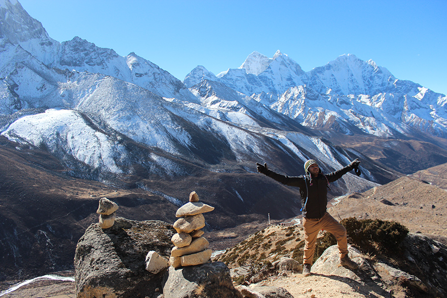
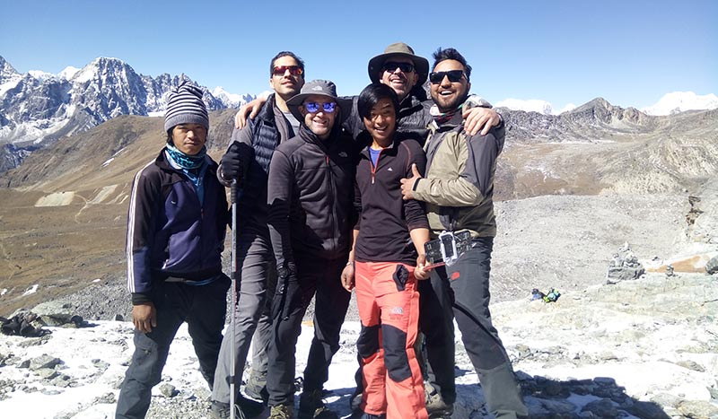
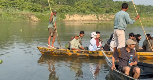
The world’s highest mountain is Mount Everest, which draws thousands of adventurers to undertake the stunning two-week trek in the Himalayas to accomplish this feat. The trail to Everest Base Camp is a popular hiking route that offers breathtaking views of Sherpa houses, lush forests, rivers, bridges, and mystical glaciers.
Trekking to Everest Base Camp is a dream for almost everyone, making it a frequently asked question about the distance of the trek. The Everest Base Camp and Kalapathar trek is a 12-day adventure journey that begins in Kathmandu and takes a small plane to Lukla for a 30-minute flight. From there, hikers follow a well-traveled path that passes through Chheplung, Ghat, and Dhadokoshi. The trek follows a day-by-day itinerary to Everest Base Camp, including two days of acclimatization at Namche Bazaarand Digboche to avoid altitude sickness. The distance of the trek from Lukla to Everest Base Camp and back is about 130 km, with a 65 km ascent and descent.
The Everest trek is a magical adventure, and it’s crucial to follow a genuine itinerary and acclimatization plan due to the High altitude. Experienced adventure hikers can complete the trek more efficiently than novice trekkers. However, our expert mountain guides suggest walking approximately 5 km a day for safety.
Some trekkers complete the EBC trek in 9 days by skipping rest days and hiking 8-9 hours a day. However, this is not advisable, especially if you have porters who may experience altitude sickness or struggle to carry heavy backpacks for extended periods.
In summary, the Everest Base Camp trek is a challenging but rewarding experience, and it’s essential to plan appropriately and prioritize safety to ensure a successful journey. Here is some expert knowledge on the distance of the trek on a day-to-day basis:
Lukla to Everest base camp trekking distance daily base:
Everest base camp map & Altitude
Day 01: Fly from Kathmandu to Lukla, then trek to Phakding(2,660m)
On the first day of our Everest Base Camp trek, we will depart from Kathmandu airport and fly to Lukla, also known as Tenzing Hillary airport, in the morning. Our flight will take approximately 30 minutes, and we will arrive at Lukla airport around 9 am. After landing, we will take a break and enjoy a delicious breakfast at a cozy restaurant before beginning our proper trek.
Our destination for the day will be either Phakding, situated at an altitude of 2,650 m/8,694 ft, or Monjo, both of which are popular areas to stay for trekkers. If you wish to stay in Phakding, the trek will take about 3 hours, and if you would like to walk further to Monjo, it will take about 5 hours. Along the way, we will pass over several bridges, traditional houses, local farmland, and rivers, offering breathtaking views of the surrounding landscape.
The distance we will trek on the first day from Lukla to Phakding is about 5.6 miles, which is approximately 9 km. If we choose to continue our journey to Monjo, the distance we will cover will be 8.8 miles, which is approximately 13 km. It’s essential to note that the trek’s distance may vary depending on the trekker’s pace, level of fitness, and the altitude they are comfortable with.
It’s crucial to start the Everest Base Camp trek at a relaxed pace and give yourself enough time to acclimatize to the high altitude. It’s also advisable to carry a daypack with essential items such as water, snacks, and rain gear. With proper preparation and a positive mindset, the first day of our Everest Base Camp trek will be a memorable experience.
Day 02:Phakding to Namche Bazaar( 3,450m)
Before reaching Namche Bazaar(3,450 m)
There are the settlements that you will encounter on the trek from Phakding to Namche in the Everest region, along with their approximate walking hours and distances:
Phakding: This is the starting point of the trek and is located at an altitude of 2,652 meters. It is about 9.2 km (5.7 miles) from Lukla and takes about 3 hours to walk to.
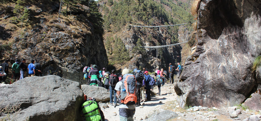
Monjo: This is a small village located at an altitude of 2,835 meters. It is situated on the banks of the Dudh Koshi River and is the entrance to the Sagarmatha National Park. It is about 2.5 km (1.5 miles) from Phakding and takes about 1 hour to walk to.
Jorsalle: This is a small village located at an altitude of 2,740 meters. It is situated on the banks of the Dudh Koshi River and is a good place to stop for a break. It is about 2.4 km (1.5 miles) from Monjo and takes about 1 hour to walk to.
Larja Dobhan: This is a small settlement located at an altitude of 2,960 meters. It is situated on the banks of the Dudh Koshi River and is a good place to rest and enjoy the scenery. It is about 1.5 km (0.9 miles) from Jorsalle and takes about 45 minutes to walk to.
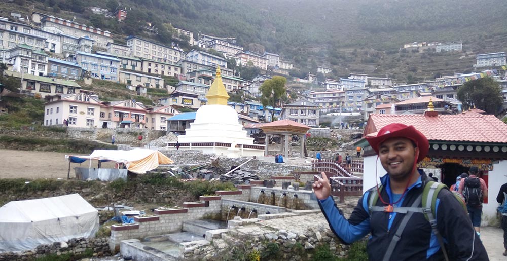
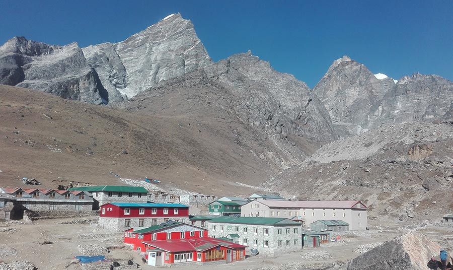
Namche Bazaar: This is the largest village in the Khumbu region and is situated at an altitude of 3,440 meters. It is a major trading center and has several shops, lodges, restaurants, and bakeries. It is about 6.6 km (4.1 miles) from Larja Dobhan and takes about 3 hours to walk to.
The trekking times and distances may vary based on individual fitness levels and the amount of time spent at each stop.
Day 3: Acclimatization day in Namce bazaar
During the acclimatization day in Namche Bazaar, it is recommended to do a hike to a higher elevation and then return back to Namche for the night. This helps the body to adjust to the higher altitude and prevent altitude sickness.
One of the popular acclimatization hikes is to the Everest View Hotel, which is located at an altitude of 3,880 meters (12,726 feet) above sea level. The round-trip distance from Namche to Everest View Hotel and back is approximately 7-8 kilometers (4-5 miles) and can take 3-4 hours depending on your pace.
Another option is to hike up to Khumjung village, which is located at an altitude of 3,790 meters (12,434 feet) above sea level. The round trip distance from Namche to Khumjung and back is approximately 8-9 kilometers (5-6 miles) and can take 3-4 hours depending on your pace.
It is important to take it easy during the acclimatization day and not to overexert yourself. Rest and drink plenty of fluids to help your body adjust to the higher altitude.
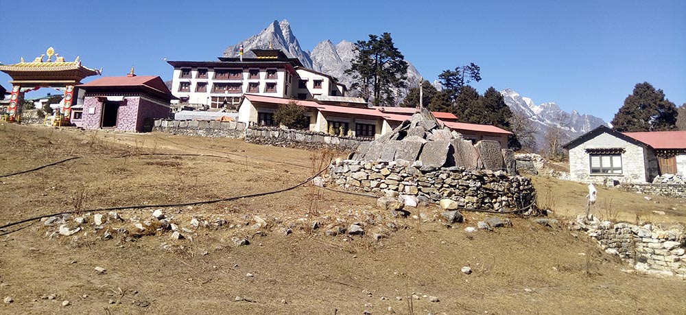
Day 04: Namche Bazaar to Tengboche(3,780m)
Tyangboche monastery
The trekking route from Namche Bazaar to Tyangboche passes through several small settlements and beautiful landscapes. Here is a description of each settlement and the distance between them:
Kenjoma (1.5 km/0.9 miles from Namche Bazaar) – A small settlement with a few teahouses and lodges. It is situated on a steep uphill section of the trail.
Sanasa (2.5 km/1.5 miles from Namche Bazaar) – A small junction where the trail forks towards Gokyo or Tyangboche. There are a few teahouses and a viewpoint with panoramic views of the mountains.
Phunki Tenga (4.5 km/2.8 miles from Namche Bazaar) – A small settlement with a few teahouses and lodges. It is situated at the bottom of a steep downhill section of the trail, where there is a bridge over the Dudh Koshi River.
Tashinga (5.5 km/3.4 miles from Namche Bazaar) – A small settlement with a few teahouses and lodges. It is situated on a steep uphill section of the trail.
Tyangboche (7 km/4.3 miles from Namche Bazaar) – A small village famous for its Buddhist monastery, which is the largest in the Khumbu region. The village has several teahouses and lodges, as well as a bakery and a small market.
The total distance from Namche Bazaar to Tyangboche is approximately 7 kilometers (4.3 miles) and can take 3-4 hours depending on your pace and the time spent at each settlement. The trail is mostly uphill, with a few steep sections and some gradual ascents. Along the way, you will enjoy stunning views of the mountains and forests, and encounter local Sherpa people and their culture.
Day 05: Tengboche to Dingboche (4,360m)
From Tengboche, we will begin our trek towards Dingboche, which is situated at an altitude of 4,410 meters. Along the way, we will pass through several settlements, each offering unique views and experiences.
Tengboche to Debuche: The distance between Tengboche and Debuche is approximately 1.5 km, and it takes about 30 minutes to walk.
Debuche to Pangboche: The distance between Debuche and Pangboche is approximately 3.5 km, and it takes about 1.5 to 2 hours to walk.
Pangboche to Shomare: The distance between Pangboche and Shomare is approximately 2 km, and it takes about 1 hour to walk.
Shomare to Orsho: The distance between Shomare and Orsho is approximately 1.5 km, and it takes about 30 minutes to walk.
Orsho to Dingboche: The distance between Orsho and Dingboche is approximately 2 km, and it takes about 1 hour to walk.
So, the total distance from Tengboche to Dingboche is around 10.5 km, and it takes approximately 4-5 hours to complete, depending on your pace and physical fitness. It’s essential to take enough breaks and acclimatize to the altitude properly during the trek to ensure a safe and enjoyable experience.
Day 06: Dingboche Acclimatization day
Dingboche Nagarkhan Hill
The distance you will walk while resting in Dingboche for two nights, including your acclimatization da,y will depend on the activities and side trips you choose to do.
On the acclimatization day, it is recommended to take a hike to Nangkartshang Peak, which is a viewpoint above Dingboche. The round-trip distance for this hike is approximately 5-6 kilometers (3-4 miles) and takes around 3-4 hours.
The next day, you will continue your trek from Dingboche to Lobuche, which is around 7.5 kilometers (4.7 miles) and takes approximately 5-6 hours depending on your pace and rest stops.
Day 07: Dingbcohe to Lobuche(4,910m)
At Lobuche (the 2nd last settlement of the Everest base camp trek)
The distance from Dingboche to Lobuche is approximately 7.5 kilometers (4.7 miles) and takes around 5-6 hours depending on your pace and rest stops. Here is a breakdown of the distance and estimated walking time for each section of the trek:
Dingboche (4,410 m) to Duglha (4,620 m): 3.5 kilometers (2.2 miles), approximately 2-3 hours of walking Duglha to Lobuche: 4 kilometers (2.5 miles), approximately 3-4 hours of walking During the trek, you will pass through the following settlements:
Dusa: a small settlement located about 30 minutes into the trek from Dingboche. It has a few teahouses for trekkers to take a rest and grab a snack or drink. Thukla: a small village located at the foot of Thukla Pass, which is a challenging uphill climb. There are a few teahouses and a memorial to climbers who have died on Everest. Lobuche: the final settlement before reaching Everest Base Camp. It is a small village with a few teahouses and lodges for trekkers to stay overnight. The altitude here is around 4,910 meters (16,108 feet).
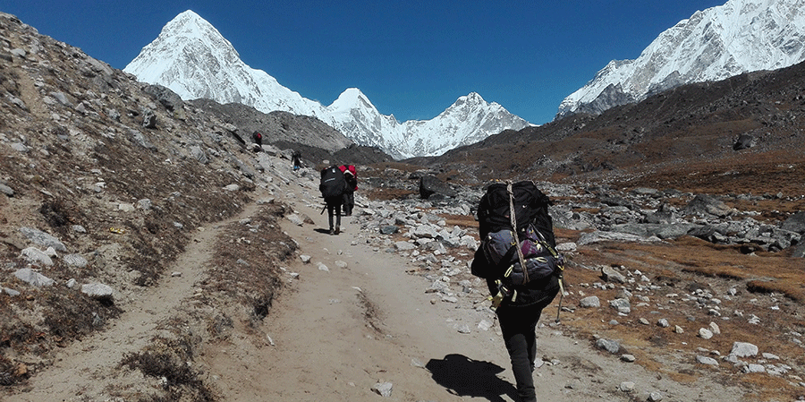
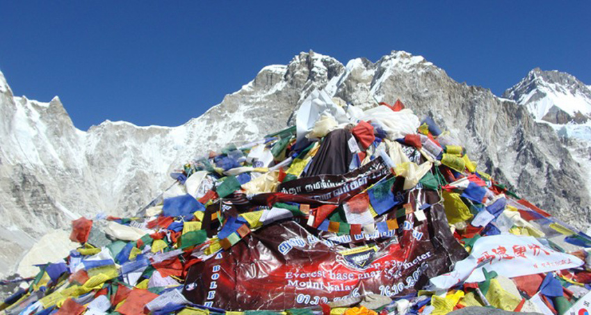
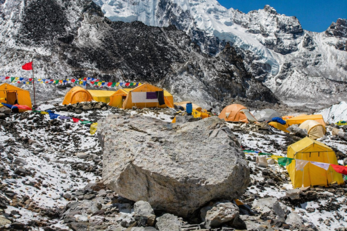
Day 08: Lobuche – Gorakshep- EBC- Gorakshep(5,180m)
The trek from Lobuche to Gorak Shep to Everest Base Camp and back to Gorak Shep is a popular trek in the Everest region of Nepal. Here’s a detailed breakdown of the distance and walking hours involved in the trek:
Lobuche to Gorak Shep Distance: Approximately 7.5 kilometers (4.7 miles) Walking time: 3-4 hours
Gorak Shep to Everest Base Camp and back to Gorak Shep Distance: Approximately 9 kilometers (5.6 miles) round trip Walking time: 6-7 hours
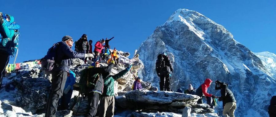
Gorak Shep to Kala Patthar and back to Gorak Shep Distance: Approximately 3 kilometers (1.9 miles) round trip Walking time: 2-3 hours
Day 9: Early Morning to Kalapathar from Gorakshep than Decent to Pheriche(4,210m)
The trek from Gorak Shep to Kala Patthar and back to Pheriche is a challenging but rewarding trek in the Everest region of Nepal. Here’s a detailed breakdown of the distance and walking hours involved in each leg of the trek:
Gorak Shep to Kala Patthar and back to Gorak Shep Distance: Approximately 3 kilometers (1.9 miles) each way Walking time: 2-3 hours each way
Gorak Shep to Pheriche Distance: Approximately 12.5 kilometers (7.8 miles) Walking time: 5-6 hours
Total distance covered during the trek: Approximately 29 kilometers (18 miles)
Total walking time during the trek: Approximately 14-16 hours, depending on pace and stops.
Note: These distances and walking times are approximate and can vary based on individual factors such as fitness level, pace, and weather conditions. It’s important to be well-prepared and informed before embarking on this trek. Also, please note that it’s recommended to acclimatize in Pheriche for a day or two before heading up to Gorak Shep and Kala Patthar to avoid altitude sickness.
Day 10: Pheriche to Namche Bazaar (3,450m)
The trek from Pheriche to Namche Bazaar is beautiful in the Everest region of Nepal. Here’s a breakdown of the distance and estimated walking time involved in the trek:
Distance: Approximately 19 kilometers (11.8 miles) Walking time: 6-7 hours
The trek starts from Pheriche and follows the Dudh Koshi River upstream towards Namche Bazaar. The trail passes through beautiful villages, forests, suspension bridges, and steep uphill and downhill sections. The highest point on the trail is the Tengboche monastery, which offers stunning views of Mount Everest, Ama Dablam, and other peaks in the region.
Note that these distances and walking times are estimates and can vary based on individual factors such as fitness level, pace, and weather conditions. It’s important to be well-prepared and informed before embarking on this trek, and to acclimatize properly to the high altitude.
Day 11: Namche Bazaar to Lukla
The trek from Namche Bazaar to Lukla is popular in the Everest region of Nepal. Here’s a detailed breakdown of the distance and walking hours involved in each leg of the trek:
Namche Bazaar to Monjo Distance: Approximately 6 kilometers (3.7 miles) Walking time: 2-3 hours
Monjo to Phakding Distance: Approximately 9 kilometers (5.6 miles) Walking time: 3-4 hours
Phakding to Lukla Distance: Approximately 9 kilometers (5.6 miles) Walking time: 3-4 hours
Total distance covered during the trek: Approximately 24 kilometers (15 miles)
Total walking time during the trek: Approximately 8-11 hours, depending on pace and stops.
Note that these distances and walking times are estimates and can vary based on individual factors such as fitness level, pace, and weather conditions. It’s important to be well-prepared and informed before embarking on this trek, and to acclimatize properly to the high altitude. Additionally, the trek can be extended or shortened depending on individual preferences and itinerary.
Day 12
The time has come to wrap up your Everest Base Camp trekking adventure, and you have just about 10 minutes of walking left to reach the airport. From there, you will board a flight to Kathmandu, where you can enjoy the breathtaking view of rolling green hills and majestic snow-capped mountains from the comfort of your plane seat. The flight typically takes about 30 minutes. Upon arrival at the Kathmandu airport, you can expect a 30-minute drive to your hotel, marking the end of your unforgettable trekking journey for this time.
How long do we have to walk every day during the Everest Base Camp trek?
The duration and distance of daily walks during the Everest Base Camp trek can vary depending on the itinerary and individual factors such as fitness level and acclimatization. Generally, the trek involves 12-14 days of walking, with an average of 5-7 hours of walking per day.
During the early days of the trek, the walking time may be shorter as you gradually gain altitude and acclimatize to the high altitude environment. As you approach higher elevations, the walking time may increase to 6-8 hours per day, with more steep uphill and downhill sections.
It’s important to note that proper acclimatization is crucial during the Everest Base Camp trek, and it’s recommended to take rest days and acclimatization hikes as needed. The itinerary should be planned in a way that allows for gradual ascent and proper rest to avoid altitude sickness and ensure a safe and enjoyable trekking experience.
In short form, we have listed the duration from one place to another in this trek, mentioning the name of the place you walking.
Trekking Days
Walking / Notes
Day 01: Lukla to Phakding
8 km — 3 hrs walk
Day 02: Phakding to Namche Bazaar
12 km — 6 hrs walk
Day 03: Acclimatization Day (Namche)
3 km — 2 hrs walks / acclimatization
Day 04: Namche to Tengboche
12 km — 6 hrs walk
Day 05: Tengboche to Dingboche
12 km — 6 hrs walk
Day 06: Dingboche (Rest Day)
3 km — 2 hrs short walks / acclimatization
Day 07: Dingboche to Lobuche
12 km — 6 hrs walk
Day 08: Lobuche – Gorakshep – Everest Base Camp – Gorakshep
15 km — 8 hrs walk
Day 09: Gorakshep – Kala Patthar – Pheriche
18 km — 7 hrs walk
Day 10: Pheriche to Namche Bazaar
22 km — 8 hrs walk
Day 11: Namche to Lukla
20 km — 7 hrs walk
Day 12: Lukla to Kathmandu (by plane)
Approx. 30-minute flight
Adventure alternative trekking routes to Everest base camp & Kalapathar
The Everest region is a vast area encompassing numerous high-altitude locations that trekkers visit. If you have at least 12 days to spare, you can explore some stunning alternative trekking routes to Everest Base Camp. One such route is the Gokyo valley trek, which takes you over the high Renjola pass at 5416m and provides an incredible opportunity to witness the breathtaking Himalayan panorama.
Here are some alternative trekking options to Everest Base Camp:
Classic Everest trek from Jiri to Everest Base Camp
Everest Base Camp and Gokyo trek via Chola pass
Everest 3 High Pass trekking
Gokyo trekking via EBC
Everest Base Camp and Island Peak climb
These alternative routes offer a chance to explore different areas of the Everest region, each with its own unique landscapes, cultures, and challenges. However, it’s important to note that these routes require a higher level of fitness and experience than the standard EBC trek. Proper preparation and a well-planned itinerary are essential for a safe and enjoyable trekking experience.
Classic Everest Trek Jiri to Everest base camp( 18 to 26 Days roughly)
Top of Kalapathar (5550 m)
The Classic Everest trek from Jiri to Everest Base Camp typically takes around 18 to 26 days to complete, depending on the itinerary and pace of the trek. This trek follows the original route taken by early Everest expeditions before the construction of the Lukla airport.
The trek starts with a scenic bus ride from Kathmandu to Jiri, from where you begin your trek to Lukla. The route passes through beautiful villages, lush forests, and scenic river valleys, providing a unique perspective on the local culture and way of life.
The trek continues through the Solu Khumbu region, passing through Namche Bazaar, Tengboche Monastery, Dingboche, and Gorakshep before finally reaching Everest Base Camp. Along the way, you’ll experience stunning views of the Himalayas, including Mount Everest, Lhotse, Nuptse, Ama Dablam, and many more.
The Classic Everest trek is a longer and less frequented route than the standard Everest Base Camp trek, offering a more authentic and remote Himalayan experience. However, the trek involves more challenging terrain and requires a higher level of fitness and endurance. Proper preparation and acclimatization are essential for a safe and enjoyable trekking experience.
Jiri to Everest base camp trekking distance is 185 km/115 Miles through the steep stone-made terrain and mostly pine forest.
Everest base camp and Gokyo trek via Chola pass(15 -18 Days roughly)
At Cholapass(5416 m)
If you have more than two weeks to spare for your Everest Base Camp trek, you can consider extending your trip to include the breathtaking Everest Base Camp and Gokyo trek via Chola Pass. This adventure-packed trek takes you through high-altitude areas that reach over 5000m on some days.
Starting from Lukla, you’ll follow the popular trekking route to Everest Base Camp before heading to Dzogla, Chola pass, Dhagnak, and eventually reaching the stunningly beautiful Gokyo valley.
Gokyo is considered one of the best settlements in the Everest region for trekkers, with its five massif blue lakes and Gokyo Ri, a popular vantage point to witness the mesmerizing sunrise and sunset over the Everest and other mighty peaks.
During this trek, you’ll walk a total distance of about 130 km.
If you’re willing to hike for 16 days, this trek comes highly recommended as it covers all the highlights of the Everest region. You’ll get to witness the world’s biggest glaciers, including Nogjompa Glacier, Khumbu Glacier, and Khumbu Icefall. You’ll also get to visit Everest Base Camp (5364m), Kalapthar (5550m), Chola pass (5420m), Gokyo Ri (5380m), and experience a scenic flight over the Himalayas.
This trek requires a good level of fitness and acclimatization due to its high altitude and challenging terrain. It’s important to properly prepare for the trek and follow a well-planned itinerary for a safe and enjoyable experience.
Everest 3 High passes trekking (20 – 22 Days)
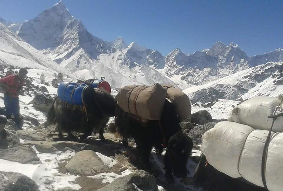
Yaks carrying luggage in the Everest region
The Everest 3 high passes trek is a challenging and thrilling adventure that takes you through some of the most remote and less-touristy areas of the Everest region. This trek is designed for experienced and professional trekkers who are looking for an ultimate challenge and want to explore the high Himalayan panoramic views.
The trek starts from Lukla, and you will follow the popular trekking trail to Everest Base Camp. The trail takes you through the picturesque Sherpa villages, dense forests, and stunning landscapes. However, the real adventure begins when you cross the three high passes: Kongma La pass at 5536 m, Cho La pass at 5420 m, and Renjo La pass at 5360 m. These passes are challenging and require proper trekking gear and the assistance of a professional mountain guide.
During the Everest 3 high passes trek, you will also have the opportunity to explore the remote and less-visited areas of the Everest region. You will witness the incredible beauty of the towering peaks, world-renowned glaciers, and stunning turquoise lakes. You will also have the chance to interact with the friendly Sherpa people, who have lived in this region for centuries and have their unique culture and traditions.
In total, you will walk around 160 km during the Everest 3 high passes trek, which usually takes around 20-22 days to complete. It is essential to have prior trekking experience and a high level of fitness to undertake this adventure. Also, make sure to carry all the necessary trekking gear and equipment to ensure your safety and comfort during the trek.
Lukla to Everest Base Camp Distance
The distance from Lukla to Everest Base Camp (EBC) is approximately 65 kilometers or 40.4 miles. However, it’s important to note that this distance can vary depending on the specific route taken, as there are a few different trails that can be followed. Additionally, the trek to EBC involves significant elevation gain and challenging terrain, so the distance alone doesn’t accurately reflect the difficulty of the trek.
Kathmandu to Everest Base Camp Distance
The distance from Kathmandu to Everest Base Camp is approximately 138 km (86 miles) in a straight line. However, since there are no roads that directly connect Kathmandu to Everest Base Camp, the distance traveled by foot during the trek is much longer. The trek usually covers a distance of around 130 km (80 miles) from Lukla to Everest Base Camp and back.
Gorakhsep to Everest base camp actual distance and walking hours
The distance between Gorak Shep and Everest Base Camp is around 3.5 kilometers (2.2 miles) each way. The walking time from Gorak Shep to Everest Base Camp and back is generally around 5-6 hours in total, depending on your speed and level of fitness. The trail is mostly flat and gradual, but there are some rocky and uneven sections to navigate. Additionally, the altitude can make the trek more challenging, so it’s important to take your time, stay hydrated, and listen to your body’s needs.
Distance from Gorakshep to Pangboche
The distance from Gorakshep to Pangboche is about 17 to 18 kilometers, and it usually takes around 6 to 7 hours to walk at a normal pace. The trail goes mostly downhill, making it easier than the way up. From Gorakshep, you follow a rocky path along the side of the Khumbu Glacier until you reach Lobuche. After Lobuche, the trail drops gently towards Thukla, where you pass the famous memorial area dedicated to climbers. From Thukla, the path continues down into the wide, beautiful valley that leads to Pheriche. This part of the walk is relaxed with open views and smooth trails. From Pheriche, you continue towards Pangboche, crossing a small bridge and enjoying stunning views of Ama Dablam. Pangboche is a peaceful Sherpa village with old monasteries and warm lodges, making it a comfortable place to rest after a long walking day.
Distance from Namche Bazaar to Lukla
The trek from Namche Bazaar to Lukla covers around 18 to 20 kilometers and normally takes 6 to 7 hours of walking at a steady pace. The trail begins with a long, steep descent from Namche, winding down through pine forests and crossing several suspension bridges over the Dudh Koshi River. This first section is the hardest on the knees because the downhill is continuous for almost two hours. After reaching the river level, the path becomes gentler, and you pass small villages like Jorsalle, Monjo, and Phakding.
From Phakding onward, the trail has a mix of short ups and downs as you continue toward Lukla. You walk through beautiful Sherpa villages, mani walls, prayer wheels, and terraced fields. The final part of the trek is an uphill climb for about 45 minutes to reach Lukla town. It is a comfortable and familiar route for most trekkers finishing the Everest Base Camp trek, offering a peaceful last day with plenty of places to rest, drink tea, and enjoy the scenery before taking your flight back to Kathmandu.
Summarize:
The Everest Base Camp trek covers a distance of approximately 130 km (80 miles) round-trip. The trek takes about 12-14 days and involves walking for an average of 5-7 hours per day. The trek starts from Lukla and passes through various settlements like Namche Bazaar, Tengboche, Dingboche, and Gorak Shep before finally reaching Everest Base Camp. The return journey involves retracing the same route back to Lukla.