
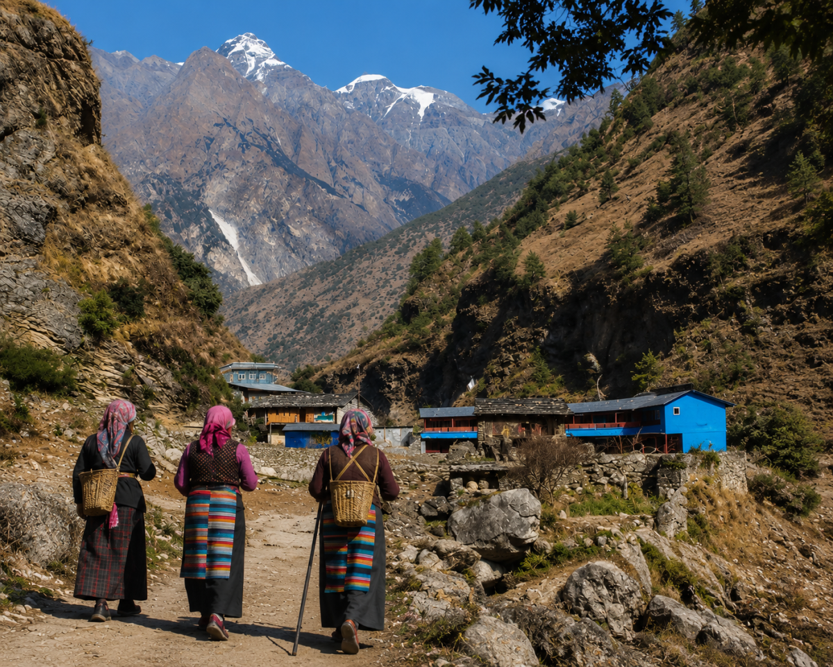
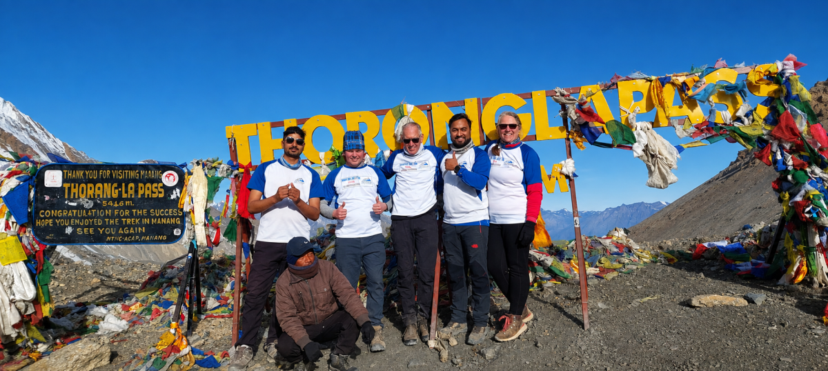

Manaslu & Annapurna Two Pass Trek Highlights: Highlights
- Budhi Gandaki Valley: Scenic trails through remote Himalayan villages.
- Tibetan Buddhist Culture: Explore traditional villages, monasteries, and local traditions.
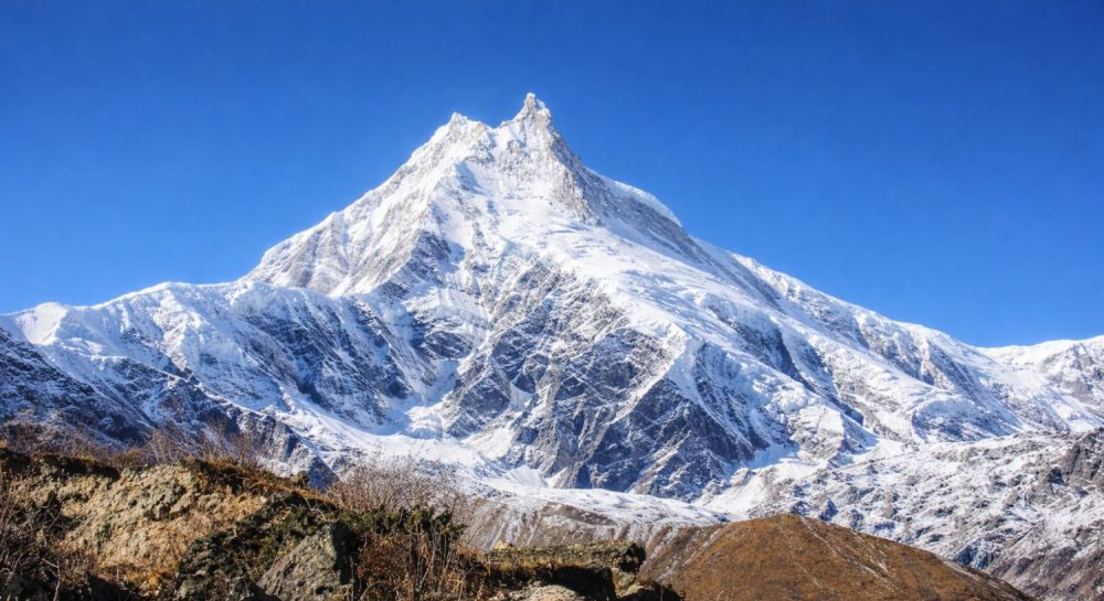
- Mount Manaslu (8,163m): Enjoy spectacular views of the world’s eighth-highest mountain.
- Sama Gaun: Experience dramatic alpine scenery beneath towering Himalayan peaks.
- Larkya Pass (5,106m): Cross the first major high mountain pass.
- Bhimtang to Dharapani: Descend through beautiful forests into the Annapurna region.
- Manang Valley: Discover traditional villages surrounded by stunning Annapurna landscapes.
- Tilicho Lake (4,919m): Enjoy an optional side trip to the spectacular lake.
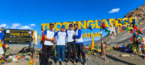
- Thorong La (5,416m): Conquer the highest and most challenging mountain pass.
- Muktinath and Mustang: Finish among sacred sites and dramatic arid landscapes.
Manaslu & Annapurna Two Pass Trek Overview: Overview
The Manaslu & Annapurna Two Pass Trek is a remarkable high-altitude trekking adventure in Nepal that brings two legendary Himalayan routes together in one continuous journey. The trek combines the remote Manaslu Circuit with the classic Annapurna Circuit, crossing Larkya Pass (5,106m) and Thorong La Pass (5,416m). Along the way, trekkers experience changing landscapes, traditional mountain communities, ancient Buddhist culture and spectacular views of the high Himalayas.
The journey begins in the Manaslu region, where the trail follows the Budhi Gandaki Valley through villages such as Machha Khola, Jagat, Deng, Namrung, Lho, Sama Gaun and Samdo. As you gain altitude, the scenery gradually changes from green hills, forests and terraced farmland to rugged alpine valleys. The magnificent Mt. Manaslu (8,163m) dominates much of this section, with surrounding peaks creating an impressive Himalayan backdrop.
Larkya Pass is the first great challenge. The crossing takes you into a high mountain environment where weather, altitude and trail conditions can make the day demanding. After descending through Bhimtang and Dharapani, the route joins the Annapurna Circuit and continues toward Chame, Pisang and Manang, where the landscape becomes increasingly dry and dramatic. Views of Annapurna II, Annapurna III, Annapurna IV, Gangapurna and Tilicho Peak add to the experience.
A Tilicho Lake side trip can be included for trekkers who have additional time and want to explore beyond the main Annapurna route. Sitting at approximately 4,919m, Tilicho Lake is surrounded by an impressive high-mountain landscape and provides another memorable highlight before the journey continues toward Thorong Phedi.
The final major challenge is Thorong La Pass at 5,416m, followed by a long descent toward Muktinath. Because both major passes are above 5,000m, this is a challenging to strenuous trek that requires good preparation, gradual acclimatization and sensible pacing. An experienced guide and porter can provide important support with navigation, permits, accommodation, baggage and high-altitude safety.
For travelers who want to extend the adventure, the itinerary can be customized with an Upper Mustang extension after Thorong La, taking the journey toward Kagbeni and the distinctive landscapes of Mustang. With two major passes, remote Himalayan villages, dramatic mountain scenery, and optional Tilicho Lake and Upper Mustang experiences, the Manaslu & Annapurna Two Pass Trek offers a deeper and more diverse Himalayan adventure than completing either circuit alone.
Who Is the Two Pass Trek Suitable For?
This trek is best suited to experienced trekkers, adventure travelers and physically fit hikers who are prepared for long walking days and high-altitude conditions. It is a particularly good choice for travelers who want to combine the remote character of the Manaslu Circuit with the dramatic high-mountain scenery of the Annapurna Circuit.
If your priority is a shorter or easier Himalayan experience, completing only one of the two circuits may be more appropriate. However, if you have sufficient time and want a more comprehensive adventure, the Manaslu & Annapurna Two Pass Trek provides an opportunity to cross two major Himalayan passes in one continuous journey.
Manaslu & Annapurna Two Pass Trek Difficulty:
The Manaslu & Annapurna Two Pass Trek is challenging to strenuous because of its length, altitude, consecutive walking days and two passes above 5,000m. The most demanding sections are normally the Larkya Pass crossing, the optional Tilicho Lake side trip, and the Thorong La Pass crossing.
The trek is not defined only by distance. Altitude gain, sleeping elevation, terrain, weather, walking hours and recovery between difficult days all affect the experience. Some days are relatively short and allow trekkers to adjust to increasing elevation, while other days require long hours of walking over steep and high mountain terrain.
Previous trekking experience is helpful, particularly experience with high-altitude trekking, although physically fit and properly prepared trekkers can undertake the journey with an appropriate itinerary and professional support.
Altitude, Acclimatization and Mountain Safety:
Altitude is one of the most important considerations on this trek. The route gradually rises from the lower valleys to more than 5,000m, making proper acclimatization essential.
Planned acclimatization around the higher Manaslu and Annapurna settlements gives the body time to adjust before the major pass crossings. Trekkers should walk at a comfortable pace, stay properly hydrated, eat regularly and communicate with the guide if they experience symptoms such as headache, dizziness, nausea, unusual tiredness or difficulty sleeping.
Acute Mountain Sickness (AMS) should never be ignored. If symptoms become serious or continue to worsen, the safest response is to stop ascending and descend to a lower elevation. Weather and individual health can also require changes to the planned itinerary, so flexibility is an important part of a safe high-altitude trek.
Why Choose Safe Holiday Adventure for This Trek?
- Local Himalayan Expertise — Safe Holiday Adventure is a locally owned, government-authorized Nepal trekking company with experience operating in the Manaslu and Annapurna regions.
- Experienced Mountain Guides — Our professional guides understand high-altitude routes, acclimatization, weather changes, and mountain safety, helping you trek with confidence.
- Carefully Planned Itineraries — We design the journey with sensible acclimatization, trekking distances, rest periods, and pass-crossing preparation.
- Complete Trekking Support — We can arrange permits, transportation, accommodation, meals, guides, porters, and essential trekking logistics from start to finish.
- Flexible and Customizable Trips — Add Tilicho Lake, Upper Mustang, extra acclimatization days, or additional porter support according to your interests and available time.
- Safety Comes First — Our team focuses on altitude awareness, responsible pacing, weather conditions, and emergency support throughout the trek.
- Transparent and Responsible Service — We provide clear communication, responsible tourism practices, and personalized support rather than treating every trekking group the same.
One Team, Two Great Circuits — With experience in both Manaslu and Annapurna trekking, we can coordinate this demanding two-pass adventure as one carefully managed journey.
OutlineOutline Itinerary
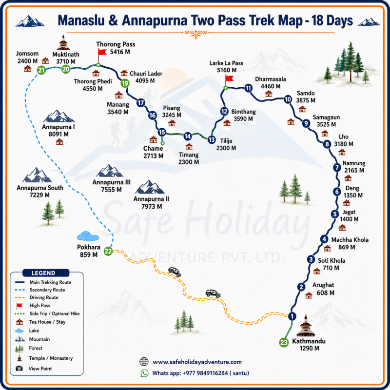
Whats Included?
- Airport Transfers: International airport pickup and drop-off in Kathmandu.
- Hotel Accommodation: 2 nights in Kathmandu and Pokhara with breakfast Near The Lake.
- Transportation: Public bus from Kathmandu to Machha Khola.
- Mustang Transportation: Public jeep or Bus from Muktinath to Tatopani.
- Pokhara Transfer: Public sharing jeep from Tatopani to Pokhara.
- Return to Kathmandu: Deluxe Tourist bus from Pokhara to Kathmandu.
- Three Meals Daily: Breakfast, Lunch and Dinner during the trek.
- Teahouse Accommodation: Basic teahouse/lodge accommodation throughout the trekking route.
- Licensed Trekking Guide: Experienced guide with salary, food, accommodation, insurance and required transportation.
- Trekking Equipment: Trekking duffle bag for porter and company T-shirt.
- Manaslu Conservation Permit: Manaslu Conservation Area Project (MCAP) permit.
- Manaslu Restricted Permit: Required restricted-area trekking permit.
- Tsum Nubri Fee: Applicable local government fee.
- Annapurna Conservation Permit: Annapurna Conservation Area Project (ACAP) permit.
- First Aid: Basic first-aid medical kit carried by the trekking team.
- Fresh Fruits: Seasonal fruits after dinner each evening during the trek
- Farewell Meal: Farewell lunch or dinner after the trek.
- Government Taxes: Applicable government taxes and service charges.
- International Flights: Flights to and from Nepal.
- Travel Insurance: Travel insurance covering trekking and emergency evacuation.
- Extra Accommodation: Additional hotel nights beyond the included itinerary.
- Porter Service: Porter service is available at an additional cost if required.
- Drinks: Tea, coffee, soft drinks, mineral water, beer and other beverages.
- Personal Expenses: Laundry, telephone calls, snacks, shopping and other personal purchases.
- Hot Shower: Hot showers and other personal bathing services where charged.
- Battery Charging: Charging fees at teahouses and lodges.
- Boiled Water: Charges for boiled or filtered drinking water where applicable.
- Additional Transportation: Transportation required because of personal itinerary changes.
- Emergency Evacuation: Helicopter or other emergency evacuation costs, unless covered by your insurance.
- Tips: Tips for the Guide, Porter, and supporting staff are not included.
Dates and Availability Departures
All our published dates are guaranteed departures. We also provide customized departures tailored to your travel plans.
October 2026
November 2026
December 2026
Travellers Reviews
Laura
USA | Feb, 2026
A Wonderful Manaslu & Annapurna Two Pass Trek Experience
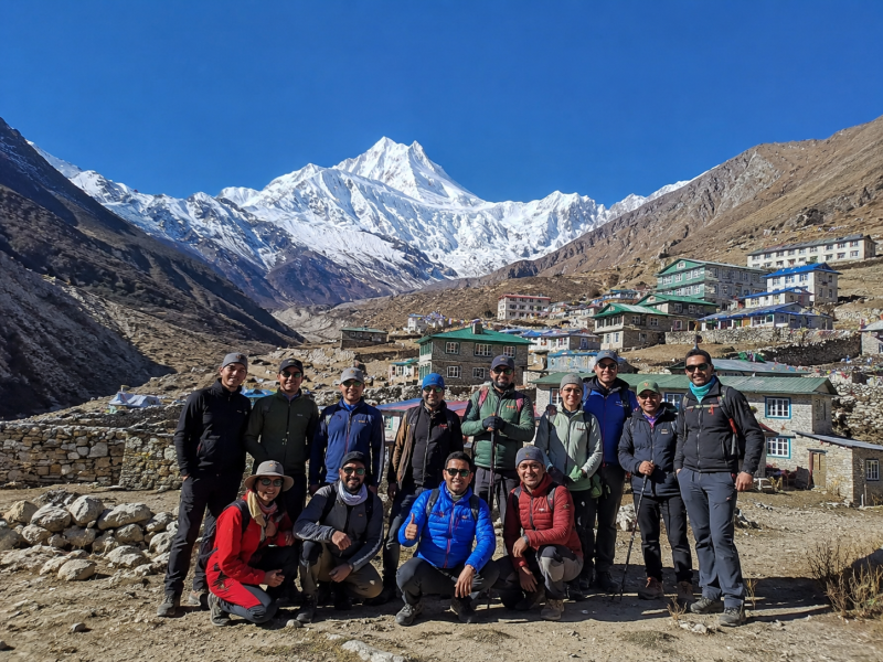
My name is Laura, and I traveled from the USA with my friends for the Manaslu & Annapurna Two Pass Trek. It was an incredible experience from beginning to end. The beautiful mountain scenery, peaceful villages, local culture, and challenging trails made this journey truly unforgettable. Every day brought something new and exciting, and sharing these special moments with my friends made the trek even more meaningful.
Our guide was very friendly, knowledgeable, patient, and professional throughout the trek. He took excellent care of our group, made sure we were comfortable and safe, and shared interesting information about the mountains, culture, and local communities. His support and positive attitude gave us confidence, especially during the more challenging sections and the high passes.
We are very grateful for such a memorable adventure in Nepal. The Manaslu and Annapurna region is absolutely beautiful, and we would happily recommend this trek to anyone looking for an authentic Himalayan adventure. Thank you to our wonderful guide and the entire team for making our trip so enjoyable and special. We will always remember this amazing experience in Nepal.

Genaral Trip InfoInfos
Best Time for Manaslu & Annapurna Two Pass Trek:
Spring (March–May)
Spring offers mild temperatures, clear mountain views and colorful rhododendron blooms. The trails are generally comfortable, making this a great season for crossing both Larkya La and Thorong La.
Autumn (September–November)
Autumn is the most popular season for this trek. The weather is usually dry and stable, with excellent visibility of the Himalayas and favorable conditions for high-pass crossings.
Winter (December–February)
Winter brings cold temperatures and snow at higher elevations. Larkya La and Thorong La can become challenging due to heavy snowfall and freezing conditions, so this season requires greater experience and preparation.
Monsoon (June–August)
The monsoon brings frequent rain, cloudy skies and slippery trails, particularly on the lower sections. Landslides and transportation delays can also affect the journey, making this the least favorable season for the full two-pass trek.
Walking Distance, Duration and Trekking Days
The total walking distance varies according to the exact starting and finishing points, road transportation and whether Tilicho Lake or Upper Mustang is added. Rather than presenting one misleading fixed distance, the final distance should be confirmed in your customized itinerary.
A standard combined program can be planned around 20–23 days, while adding both Tilicho Lake and Upper Mustang requires additional time. The itinerary can also include extra acclimatization days for trekkers who prefer a more gradual pace.
The detailed itinerary below provides the daily walking distance, estimated walking hours, starting and ending altitude, overnight village, difficulty level and major attractions for each day.
Food & Accommodation During Manaslu & Annapurna Two Pass Trek:
Teahouses along the Manaslu and Annapurna trails provide simple, filling meals such as dal bhat, noodles, rice, pasta, soups, momos, eggs and Tibetan bread. At higher elevations, food choices become more limited, so eating balanced meals and staying well hydrated is important for maintaining energy during long days and high-pass crossings.
Accommodation:
Most nights are spent in local teahouses and mountain lodges, offering basic rooms with beds, blankets and shared bathrooms. Facilities become more basic in remote Manaslu villages and at higher elevations, while the Annapurna section generally has more developed teahouses. Safe Holiday Adventure selects reliable accommodation according to availability, location and trekking conditions
Mountains and Landscapes Along the Route:
One of the greatest attractions of this journey is the variety of Himalayan scenery. Depending on the weather and viewpoint, trekkers can see some of the region’s major peaks, including:
Mt. Manaslu (8,163m), Himalchuli (7,893m), Ngadi Chuli (7,871m), Annapurna I (8,091m), Annapurna II (7,937m), Annapurna III (7,555m), Annapurna IV (7,525m), Gangapurna (7,455m), Tilicho Peak (7,134m), Pisang Peak (6,091m) and several surrounding Himalayan peaks.
The scenery changes continuously—from green subtropical valleys and terraced farmland, through pine and rhododendron forests, to Tibetan-style villages, glacial valleys, high alpine terrain and the dry landscapes of Mustang.
Permits & Required Documents for the Manaslu and Annapurna Circuit Trek:
The Manaslu and Annapurna Two Pass Trek requires several permits before entering the trekking areas. The Manaslu Restricted Area Permit is mandatory for the Manaslu section and is issued through Nepal’s Department of Immigration via a registered trekking agency. Trekkers also need the required Annapurna Conservation Area Permit (ACAP) and TIMS Card for the Annapurna section.
A valid passport, Nepal visa, travel insurance, passport-size photos, and trek details are generally required during the permit process. Our team at Safe Holiday Adventure takes care of the necessary permits and documentation, allowing you to focus on the trail, mountain scenery, and the adventure ahead.
For the latest requirements and fees, we follow the official guidelines of the Nepal Tourism Board and Department of Immigration.
Packing List for Manaslu & Annapurna Two High Pass Trek:
- Clothing: Thermal layers, fleece jacket, down jacket, waterproof jacket, trekking pants, warm hat, gloves, trekking socks, neck gaiter.
- Footwear: Waterproof trekking boots, camp shoes or sandals, gaiters.
- Trekking Gear: 40–50L backpack, sleeping bag, trekking poles, headlamp, water bottle, sunglasses, backpack rain cover.
- Personal & Health: Sunscreen, lip balm, toiletries, first-aid kit, personal medicines, water purification tablets, hand sanitizer.
- Documents & Electronics: Passport, permits, travel insurance, mobile phone, power bank, charging cables, and some Nepalese cash.
- Pack smart and light while carrying the essential gear needed for comfortable and safe crossings of Larkya La and Thorong La.
Weather & Temperature During Manaslu & Annapurna Two Pass Trek
Weather varies greatly along the route as the trail climbs from lower valleys to Larkya La and Thorong La. Lower areas can be mild and sunny, while the high passes are colder, windy and more exposed, with possible snowfall. Weather can also change quickly at high elevations.
Morning: Around 5°C–12°C in lower areas and -10°C–0°C near the high passes, with generally cooler and clearer conditions.
Daytime: Temperatures are usually 10°C–20°C at lower elevations and around -5°C–8°C at higher sections. Sunny conditions can make trekking comfortable, but strong winds may occur near the passes.
Evening & Night: Temperatures can fall quickly after sunset, reaching around 0°C–8°C in lower areas and -5°C to -15°C near high camps and passes.
Spring and autumn normally provide the best combination of stable weather, clear Himalayan views and safer conditions for crossing both high passes.
Transportation & Road Sections:
The Manaslu & Annapurna Two Pass Trek begins with a scenic but sometimes rough road journey from Kathmandu to Machha Khola, passing through Dhading, Arughat and Soti Khola. The road becomes narrower and bumpier beyond Arughat, so a private 4WD jeep is the most comfortable option. Current road access can vary with weather and construction.
Once the trek reaches the higher Manaslu region, the route becomes primarily a walking trail, with no regular road transport through the remote sections toward Larkya La Pass. After crossing the pass and reaching Dharapani, the trail connects with the Annapurna Circuit road network, where jeeps are available toward Besisahar and onward to Kathmandu or Pokhara.
Safe Holiday Adventure arranges the necessary road transportation and monitors local conditions before departure, helping make the long transfers smoother and more comfortable.
Detailed ItineraryItinerary
Arrive in Kathmandu – 1,350m
Your Manaslu & Annapurna Two Pass Trek begins with your arrival in Kathmandu. After you land at Tribhuvan International Airport, our team will meet you outside the terminal and transfer you to your hotel. Once you have checked in and had some time to rest, your guide will meet you for a short trek briefing.
In the evening, you can walk around the nearby streets of Thamel, explore the local shops, or simply relax at the hotel after your journey. Your guide will also check your trekking equipment and help you prepare anything you may need before leaving Kathmandu.
Accommodation : Hotel in Kathmandu
Kathmandu → Machha Khola – 869m
After an early breakfast, your long journey toward the Manaslu region begins. You leave Kathmandu by road and travel west toward Dhading and the lower Budhi Gandaki area. The road passes through green hills, terraced farmland, small settlements and busy local markets.
As you continue toward Machha Khola, the scenery becomes more rural and mountainous. Parts of the road are paved, while other sections can be rough and winding. After crossing and following the river valleys, you eventually reach Machha Khola, where you check into a local tea house.
This is mainly a long driving day, so you will have time to rest and prepare for your first full trekking day.
Difficulty: Easy but tiring because of the long drive
Accommodation : Lodge at Machha Khola Meals : Breakfast, Lunch & Dinner
Machha Khola → Jagat – 1,400m
Day 3: Machha Khola → Jagat – 1,400m
Wake up early, have breakfast at the tea house and begin your first full day on foot. The trail follows the Budhi Gandaki River, passing through forests, rocky sections and small mountain settlements.
You cross several suspension bridges and walk through Khorlabesi before reaching Tatopani, a village known for its natural hot springs. From here, the trail continues along the river, with several short climbs and descents.
After lunch, the trail becomes more rugged as you move deeper into the narrow valley. You cross more bridges and follow the river toward Dovan before continuing to Jagat.
By late afternoon, you arrive at Jagat, a traditional stone-built village and an important entry point to the Manaslu trekking region. After checking into your tea house, you can wash, rest and enjoy a warm dinner.
Difficulty: Moderate
Accommodation : Tea House at Jagat Meals : Breakfast, Lunch & Dinner
Jagat → Deng – 1,860m
After breakfast, the trail leaves Jagat and gradually climbs through the Budhi Gandaki Valley. You pass Sirdibas, where the landscape is still relatively green and agricultural.
The trail then continues toward Philim, one of the larger villages in this part of the Manaslu region. You will see terraced fields, waterfalls, forests and traditional houses along the way.
After Philim, the valley becomes narrower. You cross suspension bridges and follow rocky trails beside the river. The sound of the Budhi Gandaki accompanies much of the walk.
After several hours of steady walking, you reach Deng, where the surrounding mountains begin to feel much closer. The village provides a peaceful place to spend the evening.
Difficulty: Moderate
Accommodation : Lodge at Deng Meals : Breakfast, Lunch & Dinner
Deng → Namrung – 2,630m
After breakfast, you continue deeper into the Manaslu Conservation Area. The trail crosses the Budhi Gandaki and climbs through forests toward Rana and Bihi Phedi.
The landscape gradually changes as you gain altitude. Pine trees, firs and other mountain vegetation become more common, while the lower tropical vegetation begins to disappear.
You pass traditional villages and stone houses before continuing toward Namrung. The trail includes steady uphill sections, so walking slowly and drinking enough water becomes increasingly important.
As you approach Namrung, the mountain views become much more impressive. If the weather is clear, you may catch your first dramatic views of the higher Himalayan peaks.
You reach the tea house in the afternoon, giving you time to rest before dinner.
Difficulty: Moderate
Accommodation : Lodge at Namrung Meals : Breakfast, Lunch & Dinner
Namrung → Lho – 3,180m
Today you enter a more distinctly high-mountain environment. After breakfast, you walk through Namrung and continue toward Lihi, passing mani walls, chortens and traditional stone houses.
The trail climbs gradually through forests and open mountain areas before reaching Ghyang and then Lho. The scenery becomes wider and more impressive as the valley opens.
One of today’s biggest rewards is the mountain scenery. Mount Manaslu (8,163m) and surrounding peaks begin to dominate the horizon.
The walking distance is relatively short, but because you are gaining altitude, you should maintain a comfortable pace. Once you reach Lho, settle into the tea house, enjoy a hot meal and rest.
Difficulty: Moderate because of altitude gain
Accommodation : Guest House at Lho Meals : Breakfast, Lunch & Dinner
Lho → Sama Gaun – 3,525m
Wake up to the mountain scenery around Lho and have breakfast before starting toward Sama Gaun. The trail passes through Syala, with the landscape becoming increasingly open and alpine.
This is one of the most scenic days of the Manaslu section. Huge mountain walls surround the valley, and views of Manaslu, Himalchuli and other peaks become increasingly impressive.
The trail continues through forests and open grazing areas before reaching Sama Gaun. As you approach the village, the landscape becomes much drier and more rugged.
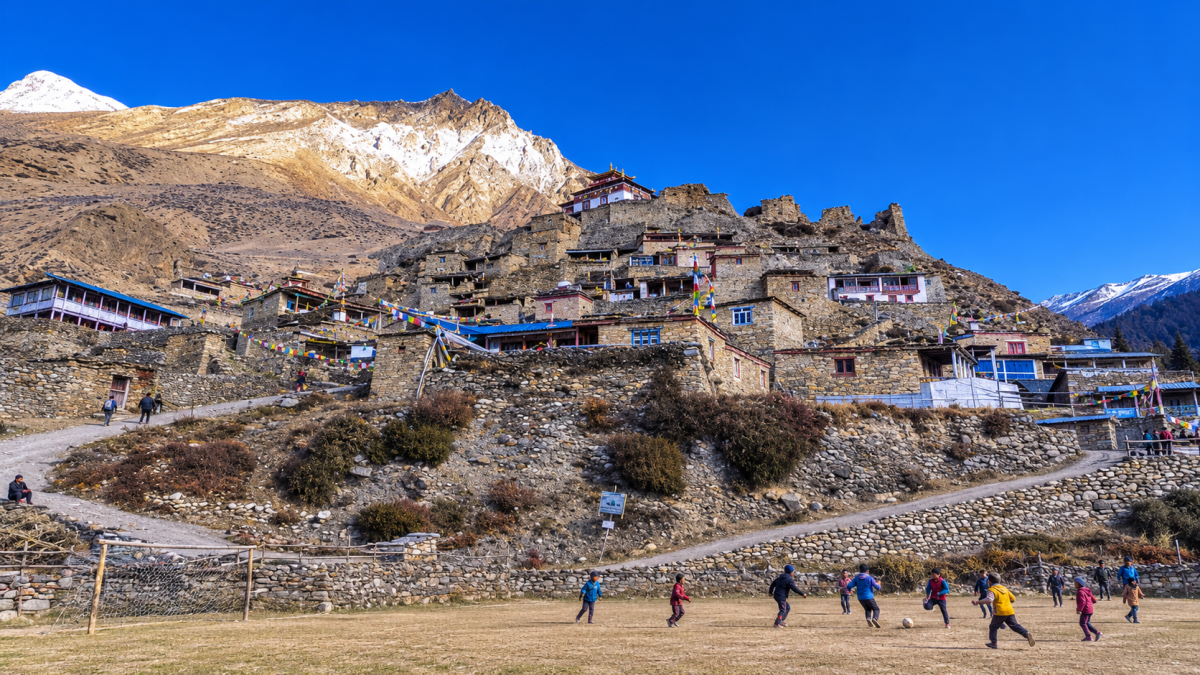
Sama Gaun is one of the most important villages on the Manaslu Circuit and has a strong Tibetan cultural influence. After arriving at the tea house, you can walk around the village and enjoy the mountain views.
Difficulty: Moderate
Accommodation : Lodhe at Sama Gaun Meals : Breakfast, Lunch & Dinner
Acclimatization Day in Sama Gaun – 3,525m
Today you do not need to pack your bags or travel to another village. Instead, you spend the day helping your body adjust to the increasing altitude.
After breakfast, your guide may take you on a short acclimatization hike around the surrounding hills. The exact hike can depend on weather, fitness and how everyone is feeling. You can also explore Sama Gaun, visit local monasteries and observe traditional mountain life.
The important rule today is climb higher during the day and return to sleep lower when possible. Keep the walking comfortable rather than treating the acclimatization hike as a race.
After lunch, you have time to relax, drink plenty of fluids and prepare your equipment for the higher trail ahead.
Difficulty: Easy to moderate
Accommodation : Lodge at Sama Gaun Meals : Breakfast, Lunch & Dinner
Sama Gaun → Samdo – 3,875m
After breakfast, you leave Sama Gaun and continue along the upper Budhi Gandaki Valley. The trail is shorter today, but the altitude makes it important to walk slowly.
Trees become increasingly sparse as you climb. The valley opens into a wide, dry landscape surrounded by high mountains. You may see yak grazing on the mountain slopes.
The trail eventually reaches Samdo, a traditional settlement close to the Tibetan border. Stone houses, prayer flags and mani walls reflect the strong Tibetan influence of the region.
Because the afternoon is usually free after reaching Samdo, you can rest, explore around the village and prepare your clothing for the colder conditions ahead.
Difficulty: Moderate due to altitude
Accommodation : Lodge at Samdo Meals : Breakfast, Lunch & Dinner
Samdo → Dharamsala – 4,460m
After breakfast, today’s walk takes you into the highest part of the Manaslu section. The trail gradually climbs away from Samdo through a dry and rugged mountain landscape.
You cross open slopes and follow the trail toward Larkya Phedi, commonly known as Dharamsala. There are fewer trees now, and the landscape is dominated by rocks, snow-covered peaks and high mountain slopes.
The walk is not particularly long, but altitude is the main challenge. Take frequent short breaks and avoid walking too quickly.
Once you reach Dharamsala, settle into the basic mountain accommodation. Your guide will usually explain the plan for the next morning because you need an early start for Larkya Pass.
Eat a good dinner, prepare your backpack and sleep as early as possible.
Overnight: Dharamsala
Difficulty: Moderate to challenging because of altitude
Accommodation : Tea House at Dharma sala Meals : Breakfast, Lunch & Dinner
Dharamsala → Larkya Pass → Bhimtang – 5,160m
This is one of the most important and demanding days of the entire trek. You wake very early, have breakfast and begin walking before sunrise.
The trail climbs slowly over rocky and sometimes snowy ground toward Larkya Pass. The air is thin at this altitude, so your guide will set a steady pace with regular breaks.
As you climb higher, the views become wider. Snow-covered peaks surround the trail, and the landscape feels completely different from the green valleys below.
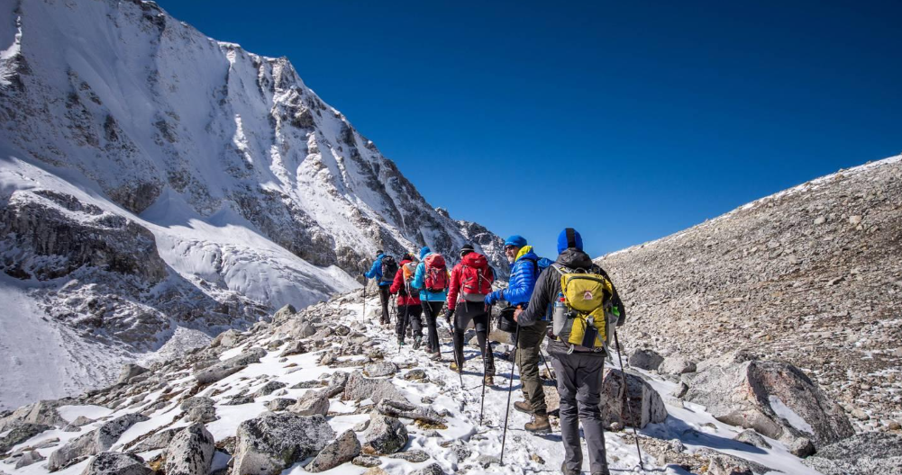
After several hours, you reach Larkya Pass (around 5,160m). Take time to enjoy the achievement and the surrounding Himalayan panorama, but do not stay too long because the weather can change quickly.
The second part of the day is a long descent toward Bhimtang. The trail drops through rocky terrain and gradually enters greener landscapes.
By the time you reach Bhimtang, you will probably be tired but proud after crossing the first major pass.
Difficulty: Strenuous
Accommodation : Tea house at Bhimtang Meals : Breakfast, Lunch & Dinner
Bhimtang → Tilije – 2,300m
After yesterday’s long pass crossing, today feels different. You begin with a gradual descent through beautiful pine and rhododendron forests.
The trail passes through Gho and continues toward Tilije. As you lose altitude, the air becomes warmer and vegetation becomes greener.
There are several sections where the trail follows forested slopes and crosses small streams. The high snowy environment of Larkya Pass slowly disappears behind you.
You reach Tilije in the afternoon and have plenty of time to relax at the tea house. This is a good recovery day after the demanding pass crossing.
Difficulty: Moderate
Accommodation : tea house at Tilije Meals : Breakfast, Lunch & Dinner
Tilije → Dharapani → Timang – 2,300m
After breakfast, continue through the lower mountain landscape toward Dharapani. The trail passes through forests and traditional villages before reaching the point where the Manaslu route connects with the Annapurna Circuit.
From Dharapani, the trail continues toward Bagarchhap and Timang. The surroundings become greener, and waterfalls, pine forests and steep mountain slopes create a beautiful Himalayan setting.
This is an important transition day because you are leaving the Manaslu section and entering the Annapurna region.
After arriving at Timang, enjoy the mountain scenery and rest at the tea house.
Difficulty: Easy to moderate
Accommodation : Tea House at Timang Meals : Breakfast, Lunch & Dinner
Timang → Chame – 2,713m
Today’s trail follows the Marsyangdi River toward Chame. After breakfast, you walk through forests and mountain villages, with occasional views opening toward the high peaks.
The trail passes through Koto before reaching Chame, the main administrative center of the Manang region.
As you approach Chame, views of Annapurna II become increasingly impressive. The combination of river, forest and huge mountain walls makes this a beautiful section of the Annapurna Circuit.
After reaching Chame, you can explore the village, visit nearby hot springs if time and conditions allow, and relax after the day’s walk.
Difficulty: Easy to moderate
Accommodation : Lodge at Chame Meals : Breakfast, Lunch & Dinner
Chame → Pisang – 3,245m
After breakfast, the trail continues through pine forests and increasingly dramatic mountain terrain. You follow the Marsyangdi Valley, passing through Bhratang and several rocky sections.
As you approach Pisang, the landscape becomes drier and the mountains appear much closer. The towering Annapurna II is one of the major highlights today.
You eventually reach Pisang, which is divided into lower and upper settlements. If conditions and energy allow, exploring the old village area provides a good opportunity to experience traditional Himalayan architecture and culture.
Difficulty: Moderate
Accommodation : Tea House at Upper Pisang Meals : Breakfast, Lunch & Dinner
Pisang → Manang – 3,540m
Today offers one of the best mountain-view walks of the entire Annapurna section.
After breakfast, you take the scenic upper route toward Ghyaru and Ngawal. The trail climbs steadily, but the effort is rewarded with wide views over the Marsyangdi Valley and the Annapurna range.
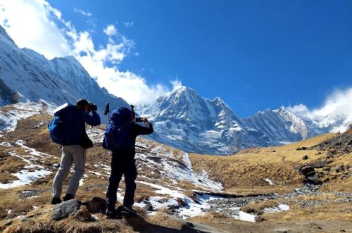
You can see Annapurna II, Annapurna III, Annapurna IV, Gangapurna and Pisang Peak, depending on weather and visibility.
After passing through Ngawal, the trail gradually descends toward the Manang Valley before reaching Manang village.
After checking into your tea house, enjoy a warm meal and rest. Manang is an excellent place to experience local mountain culture before entering the higher section toward Thorong La.
Difficulty: Moderate to challenging
Accommodation : Tea House at Manang Meals : Breakfast, Lunch & Dinner
Acclimatization Day in Manang – 3,540m
Today is another important acclimatization day. You can sleep a little longer, have breakfast and then take a short hike with your guide.
Depending on conditions, you may explore the hills above Manang or visit local cultural sites. The purpose is to spend time at altitude without overexerting yourself.
During the afternoon, return to the tea house, relax and prepare your warm clothing for the higher section. Your guide will also discuss the next few days, especially the approach to Thorong Phedi and Thorong La Pass.
Overnight: Manang
Difficulty: Easy to moderate
Accommodation : Tea House at Manang Meals : Breakfast, Lunch & Dinner
Manang → Yak Kharka – 4,095m
After breakfast, you leave Manang and begin climbing gradually toward the high alpine section.
The trail passes through Gunsang and continues across open mountain slopes toward Yak Kharka. Trees become fewer, while the landscape becomes wider, drier and more rugged.
You may see yaks and other grazing animals in the surrounding meadows. The mountains rise dramatically on both sides of the valley.
Although today’s walking time is relatively short, the altitude makes it important to walk slowly. Arriving early at Yak Kharka gives you time to rest, drink warm fluids and prepare for the next day’s climb.
Difficulty: Moderate due to altitude
Accommodation : Tea House at Yak Kharka (Ledar) Meals : Breakfast, Lunch & Dinner
Yak Kharka → Thorong Phedi – 4,550m
Today is a short but important preparation day before crossing Thorong La.
After breakfast, you follow the trail toward Ledar and then continue toward Thorong Phedi. The path climbs gradually through a barren high-altitude landscape, with steep mountain slopes surrounding the valley.
The distance is short, but the thin air makes the walk slower than it would be at lower elevations.
After reaching Thorong Phedi, settle into the tea house and rest. Your guide will check everyone’s condition and explain the early morning plan for the pass crossing.
Have an early dinner, organize your daypack and go to bed early.
Difficulty: Moderate to challenging
Accommodation : Tea House at Thorong Phedi Meals : Breakfast, Lunch & Dinner
Thorong Phedi → Thorong La → Muktinath – 3,800m
Today is the second major pass-crossing day and one of the biggest highlights of the trek.
You wake very early, usually before sunrise, have a light breakfast and begin the long climb toward Thorong La Pass. The trail rises steadily, and the thin air means you must walk slowly and take regular breaks.
As the sun rises, the surrounding mountains begin to glow. After several hours of climbing, you reach the prayer flags marking Thorong La Pass at 5,416m.
Spend a short time at the top taking photographs and enjoying the achievement. Your guide will monitor the weather because conditions at the pass can change quickly.
From the summit, the trail descends for several hours toward Muktinath. The landscape changes dramatically as you leave the snow and high alpine terrain behind.
Muktinath is an important pilgrimage site for Hindu and Buddhist communities, making the arrival here a cultural highlight as well as a trekking achievement.
Difficulty: Strenuous
Accommodation : Lodge at Muktinath Meals : Breakfast, Lunch & Dinner
Muktinath → Jomsom → Tatopani – 1,190m
After breakfast, the high-altitude trekking section is complete. Today you travel by road through the dramatic Kali Gandaki Valley.
The journey passes through Kagbeni, an ancient settlement with Tibetan-style architecture and narrow lanes. You continue toward Jomsom, the main town of Mustang, before heading south toward Tatopani.
The scenery changes rapidly during the journey. The dry, rocky landscapes of Mustang gradually give way to greener valleys, forests and waterfalls.
By the time you reach Tatopani, the air is warmer and the altitude is much lower. If time and conditions allow, you can relax and enjoy the natural hot springs for which the village is famous.
Difficulty: Easy
Accommodation : Lodge at Tatopani Hot spring Meals : Breakfast, Lunch & Dinner
Tatopani → Pokhara – 859m
After breakfast, begin the drive from Tatopani toward Pokhara. The road follows green valleys and mountain rivers, passing terraced farmland, villages, forests and waterfalls.
After many days in high mountain terrain, the lower hills feel completely different. You gradually leave the trekking environment behind and return to a more comfortable city setting.
After reaching Pokhara, check into your hotel and enjoy some free time. You can relax beside Phewa Lake, explore Lakeside or simply rest after your long Himalayan journey.
Difficulty: Easy
Accommodation : Hotel in Pokhara Meals : Breakfast
Pokhara → Kathmandu
Your final day begins with breakfast in Pokhara before the journey back to Kathmandu. The drive follows Nepal’s scenic hill roads, passing rivers, terraced hillsides and small settlements along the way.
Once you arrive in Kathmandu, your Manaslu & Annapurna Two Pass Trek comes to an end. Depending on your departure schedule, you can enjoy your final evening in Nepal, shop for souvenirs or relax at your hotel.
You leave the Himalayas having crossed Larkya Pass and Thorong La, experienced the Manaslu and Annapurna regions, and walked through some of Nepal’s most diverse mountain landscapes.
Accommodation : Hotel in Kathmandu Meals : Breakfast
Manaslu & Annapurna Two Pass Trek – Top 12 FAQs
The trek is challenging to strenuous, with long walking days, steep sections and two high-pass crossings. Good fitness and previous trekking experience are recommended.
A typical itinerary takes around 23 days, including acclimatization, trekking, transportation and the return to Kathmandu. The duration can be adjusted for private or customized trips.
The highest point is Thorong La Pass at 5,416m (17,769 ft). The route also crosses Larkya Pass at around 5,160m, making acclimatization very important.
It is not ideal for complete beginners because of the altitude and demanding pass crossings. Trekkers with good fitness and some previous hiking or trekking experience are better prepared.
Tilicho Lake is an optional side trip, depending on your chosen itinerary. At approximately 4,919m, it adds another spectacular high-altitude experience and requires additional time.
Yes. After crossing Thorong La and reaching Muktinath, you can extend the journey toward Kagbeni and Upper Mustang. The extension requires additional days and the appropriate permits.
A licensed guide is required for the restricted Manaslu section, and the necessary trekking permits are arranged through an authorized trekking agency. A porter is optional but highly useful for carrying your main luggage.
The trek requires the relevant Manaslu restricted-area permit, conservation-area permits and TIMS, according to the current route requirements. An additional restricted-area permit is required for an Upper Mustang extension. Requirements and fees can change, so they should be checked before departure.
The main trekking seasons are spring (March–May) and autumn (September–November), when mountain visibility and trail conditions are generally favorable. Winter can bring snow and difficult conditions around the high passes.
Follow a gradual itinerary, walk slowly, stay hydrated, eat properly and allow enough time for acclimatization. Never continue ascending if significant altitude symptoms are developing; inform your guide immediately.
Most trekking days involve around 3–8 hours of walking, depending on the route and altitude. The Larkya Pass and Thorong La crossing days are among the longest and most demanding.
Your guide will assess your condition and decide whether you need rest, a lower sleeping altitude or immediate descent. Serious altitude illness requires rapid descent and, when necessary, emergency medical or helicopter evacuation.
Refund & Cancellation Policy
- Booking requires 20% non-refundable deposit (Nepal) or 100% upfront (Tibet/Bhutan).
- Remaining payment due before the trip or on arrival (trip-dependent).
Cancellation charges:
- 31+ days: 20%
- 16–30 days: 45%
- 8–15 days: 75%
- 7 days or less: 90%
- Prices may change due to flights, taxes, or exchange rates.
- Trip changes are allowed, but extra costs apply.
- If the company cancels, a full refund, except for unavoidable events (some costs deducted).
- Good health and travel insurance are mandatory.
- No refund if removed for unsafe or illegal behavior.
- Travel involves personal risk, which the client accepts.