
2 Oct 2026 14 min to read
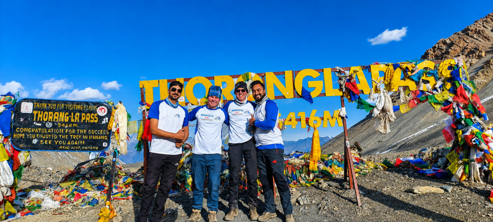
Ask anyone who has finished the Annapurna Circuit which day they remember most, and the answer is almost always the same. It is not the pine forests of the lower valley or the apple orchards of Marpha. It is the morning you leave your bed in the dark, climb through frozen air, and finally reach a string of prayer flags at 5,416 meters. The Thorong La Pass crossing is the high point of the trek in every sense, and it is also the day that asks the most of you.
The good news is that this day is very manageable when you plan it well. The pass is not technical. There are no ropes, no crampons in normal conditions, and no climbing skills needed. What it demands is good acclimatization, an early start, sensible clothing and respect for the weather. This guide walks you through each decision in the order you will face it: where to sleep, when to leave, what the climb feels like, how the descent goes, and how to judge weather and snow before you commit.
Thorong La connects two very different worlds. On the eastern side lies the wet, green Marsyangdi valley, where the trail passes waterfalls, rhododendron forest and villages shaped by Gurung and Manangi culture. On the western side lies the dry, windswept Kali Gandaki valley, a high desert of ochre cliffs, apple orchards and Tibetan-influenced villages. The pass is the doorway between them.
At 5,416 meters, it is one of the highest trekking passes in the world that regular trekkers cross without mountaineering gear. That altitude is the real challenge. The air at the top holds roughly half the oxygen found at sea level, so every step feels heavier than it should. Fit people struggle if they rush, and slower, steadier walkers often finish comfortably because they gave their bodies time.
The crossing usually takes place on the day after Yak Kharka or Letdar and the night at either Thorong Phedi or High Camp. By then, most trekkers have already spent several days above 3,500 meters. That slow build-up, combined with a rest day in Manang, is what makes the pass realistic for ordinary hikers.
This is the most common question on the circuit, and there is no single right answer. Both places are simple lodge settlements built for one purpose: to give trekkers a bed before pass day.
Thorong Phedi sits at about 4,450 meters at the foot of the climb. The word “phedi” simply means the base of a hill. It has the larger group of lodges, a livelier dining room in the evening and a better chance of finding a bed even in the busy weeks of October.
The main advantage is comfort and altitude. Sleeping around 4,450 meters is a gentle step up from Yak Kharka, and most people sleep reasonably well there. The disadvantage shows up the next morning. You begin the day roughly 970 meters below the pass, so the climb is longer, and the first hour is a steep zigzag trail that you climb by headlamp, half awake and very cold.
High Camp sits much higher, at around 4,800 meters, on a ledge above Phedi reached by a steep, rocky path of about an hour or a little more. It has fewer lodges, simpler rooms and a colder, more exposed feel.
The big advantage is a shorter pass morning. You have already done the hardest part of the climb the day before, so you leave with less distance to cover and can set off a little later. The trade-off is the altitude. Sleeping near 4,800 meters brings headaches, restless nights and poor appetite for a lot of people. Because the lodges are limited, beds can also run out when many groups arrive on the same day.
Think about how your body has responded so far. If you felt strong in Manang, slept well at Yak Kharka and had no symptoms, High Camp can save your legs on pass day and shorten your exposure to the cold. If you had even mild headaches, nausea or poor sleep along the way, Phedi is the wiser choice. A longer morning is far easier to handle than a night of altitude sickness at 4,800 meters.
A third option works well for cautious trekkers. Walk up to High Camp in the afternoon as an acclimatization hike, spend an hour or two there, and return to Phedi to sleep. This follows the old rule of climbing high and sleeping low. It costs you some energy, but it tends to leave you feeling better on the big day.
Whatever you choose, tell your guide how you feel honestly. Mild symptoms that are ignored on the way up become serious problems at the top. For more detail on spotting the early signs, read our guide to altitude sickness (AMS).
Almost every experienced guide gives the same advice: leave early. For trekkers sleeping at Thorong Phedi, that usually means getting up around 3:00 am and walking by 3:30 to 4:30 am. From High Camp, you can generally leave around 4:30 to 5:30 am.
The reason is the wind. Mornings on the pass are normally calm and clear, even when afternoons are not. As the sun warms the slopes and valleys, the air begins to move, and by late morning the wind can be strong enough to make the summit painfully cold and even dangerous. Reaching the top before about 9 or 10 am gives you a margin of safety and still leaves a long descent in front of you.
Early starts also help the descent. The trail to Muktinath is long, dry and exposed, and the afternoon sun can feel harsh. Finishing before dark is far more comfortable than arriving in the evening exhausted.
From Thorong Phedi, expect about four to five hours of steady climbing to the top. From High Camp, the climb is closer to two and a half to three and a half hours. The descent from the pass to Muktinath, losing around 1,600 meters, takes another three to four hours for most people. A full day, including breaks, typically runs seven to nine hours.
Do not look at the clock too much. Slow and constant beats fast and tired. A good rhythm is a few breaths per step on the steepest parts, small sips of water often, and short stops rather than long ones.

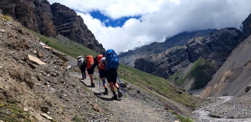
The climb begins in darkness with a steep zigzag path that gains height quickly. Your headlamp lights a narrow circle of stones, and above you a thread of other headlamps winds up the slope. Everyone walks quietly because breathing takes effort.
As the sky starts to lighten, the mountains appear one by one. The ridge becomes visible, and the trail passes through rocky terrain that can be icy early in the day. Sections of the path may be covered by hard snow, especially in autumn after a recent storm and in winter. Poles help a lot here, and so does staying at a steady pace even when you feel tempted to rush.
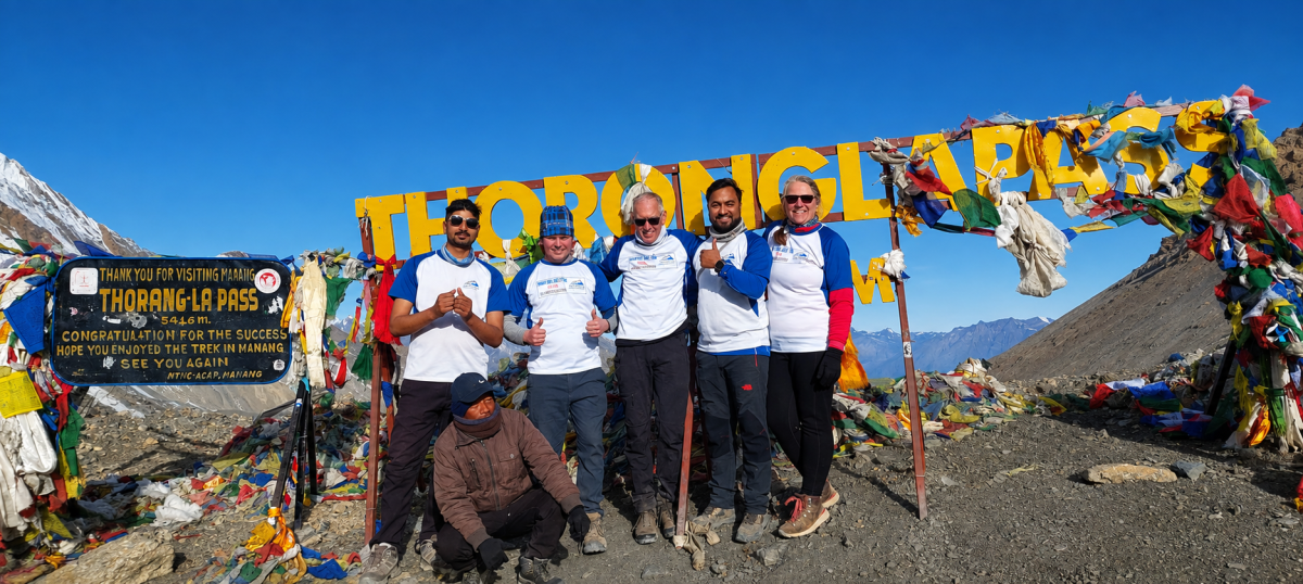
Near the top, there is a small tea house, which often provides hot tea and a rest for tired trekkers. The summit itself is marked with prayer flags, a signboard and usually a small crowd of happy, breathless people taking photos. Do not stay long. Take your pictures, eat something warm if you can, and begin the descent before the wind builds.
Many trekkers underestimate the way down. The path drops steeply on loose stones and then continues along a long, dry valley before reaching Muktinath at about 3,800 meters. It is hard on the knees, and the loss of height can make the afternoon heat noticeable.
Use poles, keep your steps short and take small breaks. Drink enough water, because dehydration sneaks up on you in the dry air. When you finally reach Muktinath, you will find lodges, hot meals and a sacred temple complex that attracts Hindu and Buddhist pilgrims alike. A visit the next morning makes a peaceful reward after such a demanding day.
Weather is the part of the Thorong La Pass crossing that no one controls, so it deserves the most attention.
The most stable conditions generally appear in autumn (October and November) and spring (March to May). Skies tend to be clearer and the trail is usually in good shape. Even so, these are mountains, and conditions can change within hours.
Winter (December to February) brings colder temperatures and a higher chance of heavy snow. The pass can become difficult or even closed after big storms, and only well-prepared groups with experienced guides should attempt it. The monsoon months (June to August) bring heavy rain to the lower valley, though the area beyond Manang sits in a rain shadow, so conditions on the pass are often drier than on the lower trail.
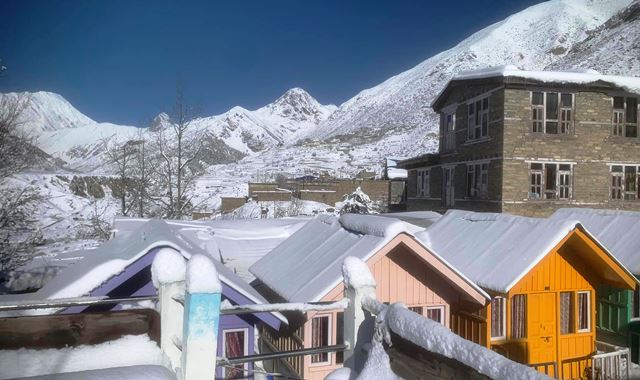
Fresh snow is the main hazard. It hides the trail, slows your pace and can cause whiteout conditions where you can barely see the markers. After a recent snowfall, local guides sometimes wait a day to let the trail settle or let other groups break a path.
The October 2014 blizzard, which caught many trekkers and local people on the pass and caused the loss of more than 40 lives, remains the reminder that this crossing can turn serious quickly. Since then, awareness, forecasts and guide training have improved greatly, but the lesson remains: the mountain sets the schedule.
The evening before, ask your guide and the lodge owners about the forecast and about what trekkers coming from the other side reported. Look at the sky at sunset. Thickening cloud, a strong wind or a sudden temperature change can all warn of a change.
On pass morning, agree with your guide on a clear turnaround rule. If you cannot see the markers, if the wind is knocking you off balance, or if someone in your group shows signs of serious altitude illness, turning back is the right choice. A pass that waits a day is far better than one that is forced.
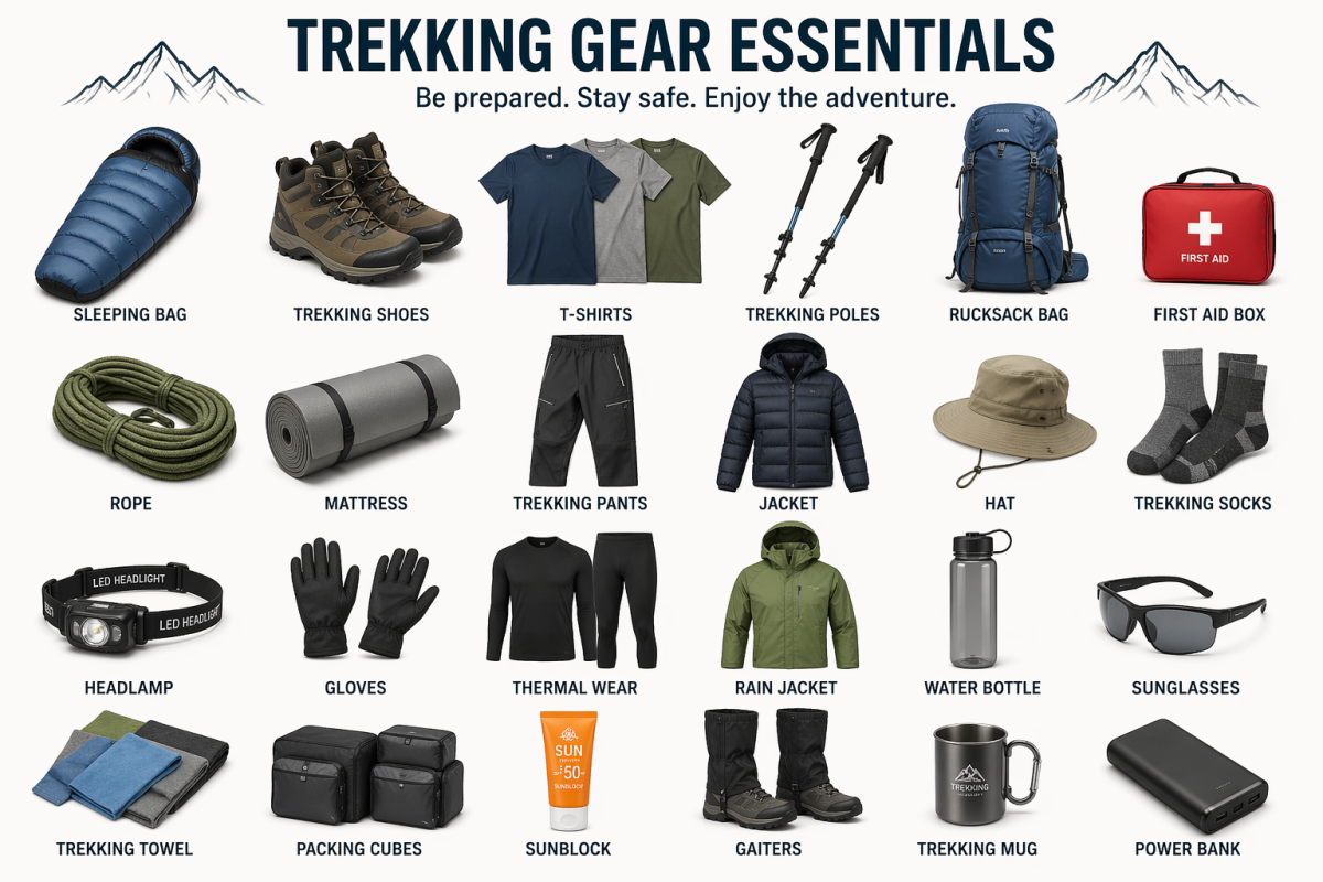
You do not need special gear, but your clothing system matters a lot. Start with layers: a base layer, a warm fleece, a down jacket and a windproof shell. Add a warm hat, thick gloves (carry a spare pair), sunglasses or glacier glasses for snow glare, and sunscreen, because UV is strong at altitude.
A reliable headlamp with spare batteries is essential, since you will walk in the dark. Trekking poles help on both the climb and the descent. Carry at least two liters of water, though bottles freeze quickly, so keep them inside your pack or use an insulated cover. Snacks such as chocolate, nuts and energy bars give quick fuel when you have little appetite.
Good boots with solid grip and warm socks are vital. Some trekkers also carry light microspikes in winter or after snow, and your guide or the lodge can advise whether they are needed.
Spend your rest day in Manang properly. A gentle acclimatization hike to Gangapurna Lake or Ice Lake, followed by a restful afternoon, prepares your body better than any pill. You can read more in our post on why acclimatization in Manang is important.
Eat well and drink plenty the day before, even when appetite is low. Warm soup and garlic soup are traditional choices on the circuit. Avoid alcohol and sleeping pills at high altitude, as both can make breathing worse at night.
If you are thinking about altitude medication, speak to a doctor before you travel. It should never replace slow, sensible acclimatization.
Finally, keep your pace honest. Many trekkers feel strong in the first hour and burn out near the top. The people who enjoy the summit most are usually the ones who walked slowest at the start.
1. How high is Thorong La Pass?
Thorong La Pass is 5,416 meters (17,769 feet) high. It is the highest point of the Annapurna Circuit.
2. How difficult is the Thorong La Pass crossing?
It is not technical, so you need no climbing skills or ropes. The difficulty comes from altitude, cold and a long day of seven to nine hours. Steady pacing and good acclimatization matter more than fitness.
3. Should I sleep at Thorong Phedi or High Camp?
Choose Phedi (about 4,450 m) if you want an easier night and a larger choice of lodges. Choose High Camp (around 4,800 m) if you feel strong and want a shorter pass morning. If you had any altitude symptoms earlier, Phedi is the safer choice.
4. What time should I start the pass crossing?
Start between 3:30 and 4:30 am from Phedi, or between 4:30 and 5:30 am from High Camp. Wind usually builds in late morning, so aim to reach the top before 9 or 10 am.
5. How long does it take to cross Thorong La?
From Phedi, the climb takes about 4 to 5 hours. From High Camp, it takes about 2.5 to 3.5 hours. The descent to Muktinath adds another 3 to 4 hours.
6. Which direction is better, Manang to Muktinath or the reverse?
Manang to Muktinath is the standard direction. It gives you a gradual climb over several days and a long descent afterward. Starting from Muktinath means a much faster gain in height, which raises the risk of altitude sickness.
7. When is the best time to cross Thorong La?
Autumn (October to November) and spring (March to May) are the most stable seasons. Skies are clearer and the trail is usually in good condition. Weather can still change quickly in any month.
8. Can you cross Thorong La Pass in winter?
Yes, but it is much riskier. Heavy snow and very low temperatures can close the pass for days. Winter crossings should only be done with an experienced guide and a flexible schedule.
9. How much snow should I expect on the pass?
It depends on the season and recent storms. In autumn and spring you may find patches of snow and ice, while after fresh snowfall the whole trail can be covered. Your guide and the lodge owners will know the latest conditions.
10. Can the pass be closed?
Yes. Heavy snow, strong wind or poor visibility can make the crossing unsafe. In that case, wait a day, or change your plan. This is why you should add a spare day to your itinerary.
11. What are the signs of altitude sickness on pass day?
Watch for a worsening headache, nausea, dizziness, unusual tiredness, poor coordination or confusion. If symptoms get worse, descend immediately and tell your guide. Never go higher with serious symptoms.
12. What should I wear and carry on pass day?
Wear layers: a base layer, fleece, down jacket and windproof shell. Add a warm hat, thick gloves, sunglasses, sunscreen and a headlamp with spare batteries. Poles, water, snacks and sturdy boots complete the kit.
13. Do I need a guide for the Thorong La Pass crossing?
Many experienced trekkers cross without one, but a local guide helps a lot with route-finding, pacing and weather decisions. Trekking rules can change, so confirm current requirements with your trekking agency.
14. Where can I get hot food and water on the way?
Both Phedi and High Camp have lodges that serve food and hot drinks. There is a small tea house near the top of the pass, but it may not always be open, so carry your own water and snacks.
15. What happens after the pass?
You descend to Muktinath (about 3,800 m), where you can rest, eat and visit the sacred temple. From there, the trail continues through Kagbeni and Jomsom, and you can return by jeep or flight.
A successful Thorong La Pass crossing comes down to a few honest decisions: sleep at the village that suits your body, leave early, watch the weather and move at a pace you can sustain. Do that, and the moment you stand beneath the prayer flags, with the Himalayas stretched out on both sides, becomes one of the most memorable of your life.
If you would like to cross the pass with experienced local guides who know every turn of the trail, explore our Annapurna Circuit Trek and plan your journey with Safe Holiday Adventure.

Introduction Kathmandu doesn’t ease you in. You step out of the airport into a chorus of horns
Continue Reading
Every Everest Base Camp trekking package includes a line item for “guide” and “por
Continue Reading
Understanding Everest Base Camp Trek Permits Cost is one of the first things every Everest Region tr
Continue Reading
Introduction Namche Bazaar is the beating heart of the Khumbu region and the first major stop for ev
Continue Reading
Standing at the foot of the world’s highest mountain is a moment that stays with you forever.
Continue Reading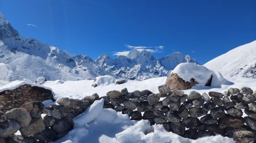
The Everest Base Camp trek is moderate to hard. There is no climbing, no ropes and no technical skil
Continue Reading