

17 Sep 2026 17 min to read
The Gokyo Lakes and Gokyo Ri Trek is one of the most rewarding ways to explore the Everest region without following the busiest route all the way to Everest Base Camp. The trail climbs through the Dudh Koshi Valley, passes traditional Sherpa settlements and alpine pastures, and eventually reaches the remarkable Gokyo Valley, where a chain of high-altitude lakes sits beneath some of Nepal’s highest mountains.
The highlight is not only Gokyo Village or its blue-green lakes. A sunrise climb to Gokyo Ri at 5,357 metres opens a remarkable Himalayan panorama, with Everest, Lhotse, Makalu and Cho Oyu visible from the viewpoint in clear conditions. The enormous Ngozumpa Glacier adds another dramatic feature to the landscape.
For trekkers looking for mountain scenery, Sherpa culture, glacier views and a quieter alternative to the standard Everest Base Camp route, Gokyo offers a memorable Himalayan experience.
| Trek Information | Details |
|---|---|
| Trek Name | Gokyo Lakes and Gokyo Ri Trek |
| Region | Everest / Khumbu, Nepal |
| Highest Viewpoint | Gokyo Ri – 5,357 m |
| Main Attraction | Gokyo Lakes and Ngozumpa Glacier |
| Difficulty | Moderate to challenging |
| Typical Duration | 11–14 days |
| Starting Point | Lukla |
| Accommodation | Teahouses and lodges |
| Best Seasons | March–May and September–November |
| Guide Option | Local experienced trekking guide |
| Price | From USD 1,150 per person* |
The final cost depends on group size, itinerary, permits, accommodation, transportation and included services.
The Gokyo route shares its first section with the Everest trekking corridor. From Lukla, the trail follows the Dudh Koshi River toward Namche Bazaar, where trekkers normally spend time adjusting to the increasing elevation.
After Namche, the route turns toward Dole and Machhermo rather than continuing toward Tengboche and the Everest Base Camp trail. The change is noticeable. Forest gradually gives way to open mountain terrain, yak grazing areas and wide views of the surrounding peaks.
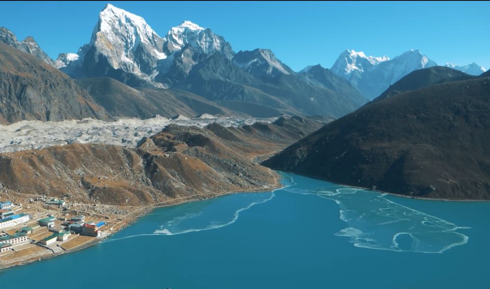
The scenery becomes particularly impressive around Gokyo. Blue-green lakes, rocky slopes, snow-covered mountains and the massive Ngozumpa Glacier create a landscape that feels completely different from the lower valleys.
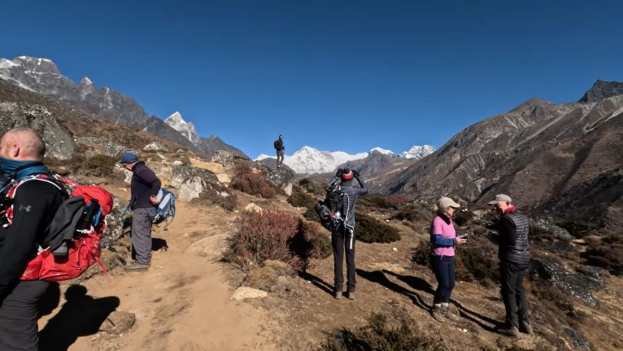
The journey to Gokyo is as important as reaching the lakes themselves.
From Namche, the trail climbs toward Dole and then continues through Machhermo. As the altitude increases, vegetation becomes thinner and the surrounding mountains appear much larger.
After Machhermo, the trail follows the Dudh Koshi toward the Gokyo Valley. Several high-altitude lakes appear along the route before you reach Gokyo Village beside the third lake.
Gokyo is small but well known among trekkers. Teahouses provide simple accommodation and meals, while the surrounding mountains make the village an ideal place to slow down and enjoy the high Himalayan environment.

For many trekkers, Gokyo Ri is the defining moment of the journey.
The climb usually begins early in the morning while the valley is still dark. The path is steep in places, and the thin air makes the ascent more demanding than the distance might suggest.
As daylight reaches the mountains, the view gradually opens. From the summit, you can look across the Gokyo Valley and surrounding peaks, with the Ngozumpa Glacier stretching through the landscape below.
On clear days, the panorama includes Mount Everest, Lhotse, Makalu and Cho Oyu. The changing morning light can make the mountains appear completely different from one moment to the next.
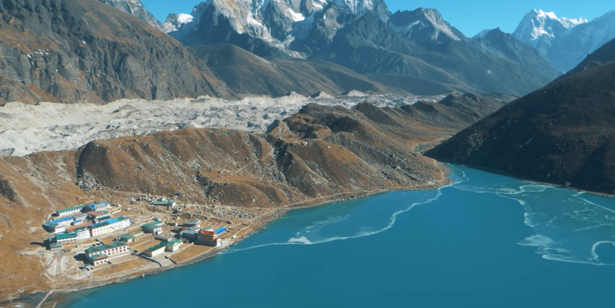
The lakes are the heart of this trek.
Several glacial lakes are scattered through the upper valley, with the main Gokyo settlement located beside the third lake. Their colour can change according to sunlight, weather and surrounding conditions.
The nearby Ngozumpa Glacier is another major feature of the area. It is one of the most impressive glacier systems in the Everest region and gives the upper valley a rugged, remote character.
For photographers, the combination of lakes, glacier, prayer flags and Himalayan peaks provides countless opportunities for memorable photographs.
Classic out-and-back route – 11 to 14 days including Kathmandu
This classic Gokyo Lakes itinerary follows the Dudh Koshi Valley from Lukla to Gokyo, with a proper acclimatization day in Namche Bazaar and time to climb Gokyo Ri. We stay overnight in comfortable local teahouses and adjust the walking pace according to weather, trail conditions and your fitness.
Distance: 8–9 km | Walking time: 3–4 hours
Altitude: Lukla 2,860 m → Phakding 2,610 m
We start early with a scenic flight toward Lukla, flying over the hills and gradually approaching the mountains of the Khumbu region. After landing at Lukla, we meet our trekking staff, organize the bags and begin walking.
The first section is relatively gentle as we follow the Dudh Koshi River through pine forest and small Sherpa settlements. Along the trail, you will see mani stones, prayer flags, small chortens and suspension bridges connecting the villages.
We take a comfortable lunch break at a local teahouse around Ghat or Phakding. After lunch, we continue at an easy pace to Phakding, where you can relax and enjoy your first evening in the mountains.
Highlights: Lukla mountain flight, Dudh Koshi River, suspension bridges, Sherpa villages and prayer flags.
Lunch: Local teahouse around Ghat or Phakding.
Overnight: Phakding teahouse.
Distance: 11–12 km | Walking time: 5–6 hours
Altitude: 2,610 m → 3,440 m
After breakfast, we continue north along the Dudh Koshi River. The trail passes through small settlements and several suspension bridges before reaching Monjo, the entrance area of Sagarmatha National Park.
From here, the mountain environment becomes more noticeable. We continue toward Jorsalle and cross several bridges before reaching the famous Hillary Suspension Bridge. After crossing, the trail begins a steady uphill climb toward Namche Bazaar.
This final climb takes some effort, so we walk slowly and take short breaks whenever needed. As we approach Namche, the first impressive Himalayan peaks may appear through the trees in clear weather.
Namche Bazaar is the main trading and service centre of the Khumbu region. After checking into the teahouse, you can explore the narrow streets, shops and local bakeries or simply rest.
Highlights: Sagarmatha National Park, Hillary Suspension Bridge, Dudh Koshi River and first Himalayan views.
Lunch: Jorsalle or another suitable teahouse on the trail.
Overnight: Namche Bazaar teahouse.
Distance: 4–8 km side hike | Walking time: 3–5 hours
Altitude: Sleep at 3,440 m | Hike up to approximately 3,880 m
Today is an important acclimatization day. We do not simply stay inside the teahouse all day. Instead, we take a gradual morning hike to a higher elevation and return to Namche to sleep.
Depending on weather and your condition, we can walk toward the Everest View Hotel and nearby viewpoints. From the higher ridges, you may see Everest, Lhotse, Ama Dablam, Thamserku and other peaks.
After the hike, we return to Namche for lunch and have the afternoon to explore the town. You can visit the local market, enjoy a coffee or bakery stop, or visit the Sherpa cultural museum if you are interested.
This slower day gives your body valuable time to adjust before we continue toward the higher Gokyo Valley.
Highlights: Everest View Hotel area, Everest and Ama Dablam views, Namche market and Sherpa culture.
Lunch: Everest View area or Namche Bazaar.
Overnight: Namche Bazaar teahouse.
Distance: 10–12 km | Walking time: 5–6 hours
Altitude: 3,440 m → approximately 4,040 m
Today we leave the main Everest Base Camp route and take the trail toward the Gokyo Valley. The atmosphere becomes noticeably quieter as we leave the busier trail behind.
The path initially climbs above Namche through pine and rhododendron forest. We continue toward the Mong La area, where the trail opens to beautiful mountain views. After taking time for photographs and a short rest, we descend toward Phortse Thanga before beginning another gradual climb to Dole.
The scenery changes as we gain altitude. Trees become shorter, the valley opens up and the mountains begin to dominate the landscape.
After reaching Dole, we check into our teahouse and have time to rest. If the weather is clear, the afternoon light can create excellent views across the surrounding peaks.
Highlights: Quieter Gokyo trail, Mong La viewpoint, rhododendron forest, mountain panoramas and Dole village.
Lunch: Mong La or Phortse Thanga.
Overnight: Dole teahouse.
Distance: 5–7 km | Walking time: 4–5 hours
Altitude: Approximately 4,040 m → 4,470 m
We have a shorter walking day today, but the increasing altitude means we continue at a comfortable pace.
After breakfast, the trail climbs gradually through open alpine landscapes. The forest becomes thinner and we start seeing more yak grazing areas and rocky mountain slopes.
We pass small settlements such as Lhabarma and Luza before continuing toward Machhermo. Along the way, we stop regularly for photographs and short breaks rather than rushing toward the destination.
Machhermo is an important overnight stop before Gokyo. Once we arrive, your guide can explain the local environment and the importance of taking care of yourself at this elevation.
The afternoon is best spent relaxing, drinking plenty of fluids and preparing for the next day’s walk toward the lakes.
Highlights: Alpine landscape, yak pastures, open mountain views and gradual acclimatization.
Lunch: Lhabarma or Luza teahouse.
Overnight: Machhermo teahouse.
Distance: 7–9 km | Walking time: 4–5 hours
Altitude: 4,470 m → 4,790 m
Today is one of the most exciting days because we finally enter the famous Gokyo Valley.
After breakfast, we follow the valley toward the Ngozumpa Glacier. The landscape becomes increasingly rugged, with rocky slopes and snow-covered peaks surrounding the trail.
As we continue, the first Gokyo Lake comes into view, followed by the second lake. We walk beside the blue-green water and across the glacial landscape before reaching Gokyo Village beside the third lake, also known as Dudh Pokhari.
From Gokyo, the views are spectacular. Cho Oyu rises dramatically in the distance, while the Ngozumpa Glacier stretches through the valley.
After lunch and check-in, we keep the afternoon relaxed. Depending on your energy and weather, we can take a short walk around the lake and prepare for the early morning Gokyo Ri climb.
Highlights: First Gokyo Lakes, Ngozumpa Glacier, Cho Oyu and arrival at Gokyo Village.
Lunch: On the trail or at a teahouse near Gokyo.
Overnight: Gokyo teahouse.
Distance: 3–6 km | Walking time: 4–7 hours
Altitude: Sleep at 4,790 m | Gokyo Ri 5,357 m
We wake early today for one of the major highlights of the trek: Gokyo Ri.
After a light breakfast or hot drink, we begin walking before sunrise. The climb is steep, and because of the altitude we move slowly with regular short breaks. There is no need to rush—the goal is to reach the viewpoint safely and enjoy the changing mountain scenery.
As the sun rises, the surrounding peaks gradually light up. From Gokyo Ri, clear-weather views can include Everest, Lhotse, Makalu and Cho Oyu, together with the Gokyo Valley, turquoise lakes and Ngozumpa Glacier below.
After spending time at the summit, we carefully descend to Gokyo for breakfast and rest.
If you still feel comfortable, the afternoon can be used for a gentle walk around the lakes or toward the higher lakes. Otherwise, relaxing beside the third lake is a perfect way to enjoy the afternoon.
Highlights: Gokyo Ri sunrise, Everest panorama, turquoise lakes, Ngozumpa Glacier and Cho Oyu.
Lunch: Gokyo teahouse or packed lunch depending on the day’s plan.
Overnight: Gokyo teahouse.
Distance: 10–12 km | Walking time: 5–6 hours
Altitude: 4,790 m → approximately 4,040 m
After breakfast, we leave Gokyo and begin retracing our route through the valley.
The return journey gives you another opportunity to enjoy the lakes and glacier views from a different perspective. Although we have already walked this trail, the scenery often looks completely different in the morning light.
As we descend toward Machhermo and then Dole, the air gradually becomes thicker and breathing feels easier. The trail is mostly downhill, although rocky sections can be tiring on the knees, so we continue carefully.
We arrive in Dole in the afternoon, check into the teahouse and enjoy a relaxed evening after the higher-altitude days.
Highlights: Final views of Gokyo Lakes, glacier scenery, alpine valleys and easier breathing at lower elevation.
Lunch: Machhermo or Luza.
Overnight: Dole teahouse.
Distance: Approximately 11 km | Walking time: 5–6 hours
Altitude: Approximately 4,040 m → 3,440 m
Today we continue downhill through the changing landscape. The alpine terrain gradually gives way to thicker vegetation as we lose elevation.
We pass Phortse Thanga and climb toward the Mong La area before continuing along the familiar trail toward Namche. The return to Namche often feels refreshing after several nights at higher elevations.
Once we arrive, you can enjoy a hot shower, visit the local shops or relax in one of the cafés and bakeries. It is also a good opportunity to enjoy a more comfortable evening before our final trekking days.
Highlights: Forest trail, changing vegetation, mountain views and return to lively Namche Bazaar.
Lunch: Phortse Thanga or Mong La.
Overnight: Namche Bazaar teahouse.
Distance: 17–19 km | Walking time: 6–7 hours
Altitude: 3,440 m → 2,860 m
After breakfast, we begin our final full day of trekking. The trail descends through the forests toward Monjo and follows the Dudh Koshi River through Phakding and the surrounding villages.
We cross the suspension bridges again and gradually leave the higher mountain environment behind. Although the trail is familiar, it is common to notice small details that were missed during the first days when we were focused on reaching Namche.
We stop for lunch along the way before continuing toward Lukla. Once we reach Lukla, we check into our teahouse and have time to relax.
In the evening, we can celebrate the completion of the trek with the guide and trekking team. We also confirm the next morning’s flight arrangements.
Highlights: Dudh Koshi Valley, suspension bridges, Phakding and completion of the main trek.
Lunch: Phakding, Monjo or another suitable teahouse.
Overnight: Lukla teahouse.
Flight time: Approximately 30–40 minutes, subject to weather and airport operations
After breakfast, we head to Lukla airport for the flight back to Kathmandu or, during some seasons, Ramechhap with onward road transportation to Kathmandu.
The flight provides a final opportunity to look back at the mountains and valleys you have just crossed on foot.
After arriving in Kathmandu, our team can transfer you to your hotel. You can then spend the rest of the day relaxing, exploring the city or shopping for souvenirs before your international departure.
Important: Mountain flights can be affected by weather and operational conditions. We strongly recommend keeping at least one extra buffer day in your overall Nepal travel schedule.
If you have additional time and want a more challenging Gokyo adventure, the itinerary can be extended toward:
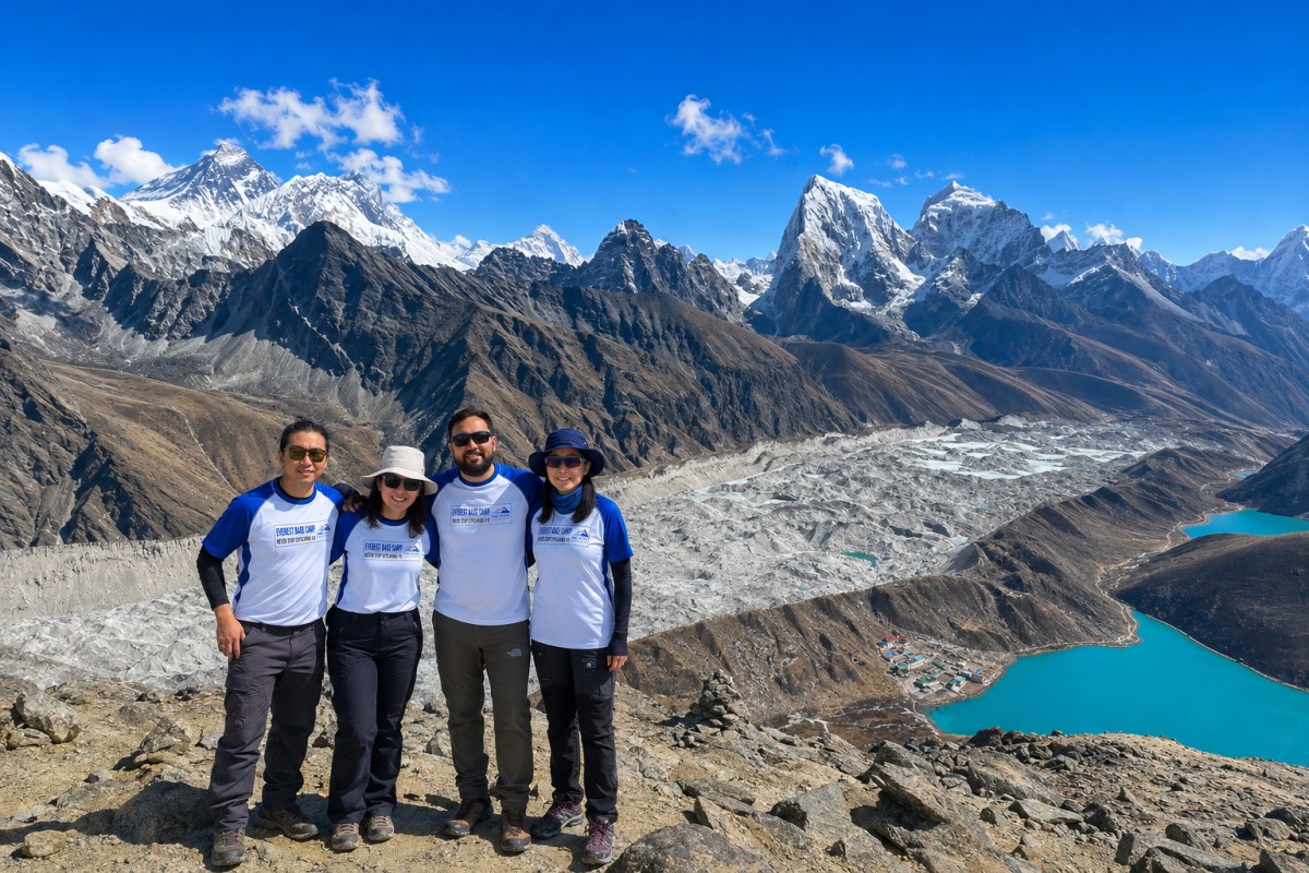
The Gokyo Lakes Trek is considered moderate to challenging. There is no major technical climbing on the standard route, but altitude makes the trek demanding.
Most walking days involve several hours on mountain trails with uphill and downhill sections. The climb to Gokyo Ri is particularly strenuous because of the elevation.
Good preparation helps. Regular walking, stair climbing, hiking and cardiovascular exercise before your trip can make the long trekking days more comfortable.
More importantly, altitude should never be treated as a fitness competition. A strong itinerary includes gradual elevation gain, acclimatization and enough time to respond to changing conditions.
The main trekking seasons are spring and autumn.
March to May brings generally favourable trekking conditions, with increasingly warm weather at lower elevations and colourful rhododendron forests during the spring months.
September to November is another popular period. After the monsoon, mountain visibility is often excellent, and the dry conditions are suitable for high-altitude trekking.
Winter trekking is possible, but temperatures can become very cold and snow may affect higher trails. The monsoon season can bring rain, clouds, slippery paths and reduced mountain visibility.
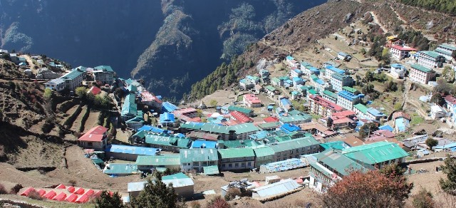
Altitude is one of the most important considerations on the Gokyo route.
Namche Bazaar is normally used as the first major acclimatization point. Rather than rushing through the itinerary, a sensible schedule allows time for your body to adjust before moving higher.
During acclimatization days, your guide can recommend short hikes to higher elevations before returning to sleep at a lower altitude.
Watch for symptoms such as persistent headache, nausea, dizziness, unusual tiredness or loss of appetite. If symptoms become worse, tell your guide immediately. Going higher while experiencing significant altitude-illness symptoms can be dangerous.
Your guide should monitor your condition throughout the trek and adjust the walking plan when necessary.
The Gokyo route is not only about mountains and lakes. It also passes through communities shaped by centuries of Himalayan life.
Sherpa villages contain Buddhist monasteries, prayer wheels, chortens, mani walls and colourful prayer flags. Local people continue to depend on tourism, livestock and traditional mountain livelihoods.
A local guide can help explain the meaning behind these cultural features rather than simply walking past them. Respect for monasteries, religious objects, local customs and private homes is an important part of responsible trekking.
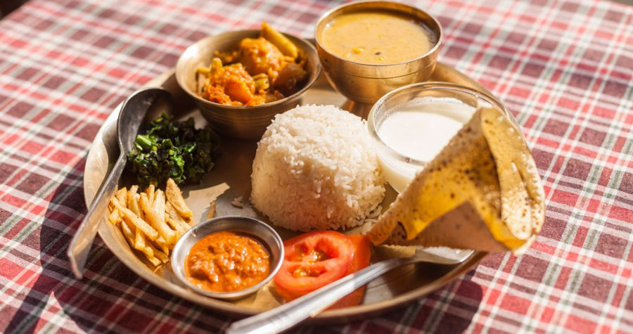
Teahouses along the Gokyo route serve simple meals designed for trekkers.
Common choices include:
Food choices become more limited as you climb higher, so carrying a few personal snacks can be useful.
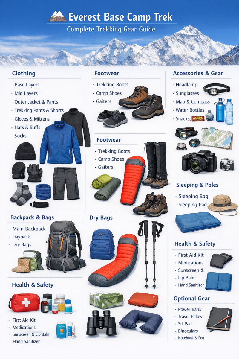
You do not need to carry your entire home into the Himalayas, but proper clothing and trekking equipment are important.
Essential items include:
Your exact packing list should depend on the season and itinerary.
The total Gokyo Lakes Trek cost depends on the length of the trek, group size, transportation, accommodation and services included in your package.
Our Gokyo Lakes Trek package starts from approximately USD 1,150 per person. The package can be arranged with a local experienced guide and includes the necessary trekking arrangements according to the selected itinerary.
For an exact quotation, we recommend confirming your preferred travel dates, group size and whether you want additional days or a longer route.
A local guide does more than lead the way.
An experienced guide understands the trail, weather changes, altitude concerns, teahouse options and local communities. They can also explain Sherpa culture, Buddhist traditions and the meaning behind places you encounter during the trek.
For independent-minded travellers, a local guide can provide support while still allowing you enough personal space to enjoy the mountains.
Our team can arrange the trek around your available time, preferred pace and budget.
Gokyo is a strong choice if you want a high-altitude Himalayan trek with dramatic lakes, glaciers and mountain viewpoints.
It is particularly suitable for travellers who want:
If you have limited time, the standard Gokyo route can be planned as a focused trek. If you have more time and experience, it can also be combined with high passes or the Everest Base Camp route.
The Gokyo Lakes Trek brings together high Himalayan scenery, glacial lakes, Sherpa culture and one of the most impressive viewpoints in the Everest region.
If you are planning your trek for the coming season, we can help arrange the itinerary, local guide, permits, accommodation and transportation according to your travel dates and group size.
Ready to explore Gokyo Lakes? Contact Safe Holiday Adventure for a personalized itinerary and current trekking price.
Email: SafeHolidayAdventure@gmail.com
WhatsApp / Call: +977 9849116284
Website: safeholidayadventure.com
The Everest Base Camp trek is moderate to hard. There is no climbing, no ropes and no technical skil
Continue Reading
Manaslu Circuit Trek weather is more complicated than simply checking the forecast before leaving Ka
Continue Reading
The Gokyo Lakes Trek is one of the most beautiful trekking journeys in Nepal’s Everest region.
Continue Reading
A clear and honest update for travelers planning Everest, Annapurna, Manaslu, Mustang and other popu
Continue Reading
Manang is one of the most important stops on the Annapurna Circuit Trek. After several days of walki
Continue Reading
If you are wondering where to see red pandas in Nepal, the Langtang region is one of the most releva
Continue Reading